It's a Pittie-full Life
  • Home
  • Travels with Tucker
  • Is it Tucker-Tough?
  • Precious Cargo
  • Renovating Rover
  • Tucker's Favorite Folks

Travels with Tucker

I'm not John Steinbeck and Tucker is certainly no Charley. But after our first year together travelling over 14,000 miles, criss-crossing America, hitting 17 states, I thought it was about time we started documenting our adventures.

Max Patch, Maximum Wind Speed

5/29/2016

0 Comments

 
Max Patch is listed as a moderate hike, and the very first sentence of the first paragraph of its description is “If Max Patch is not the ultimate hiking destination for dogs, then it comes pretty close.”

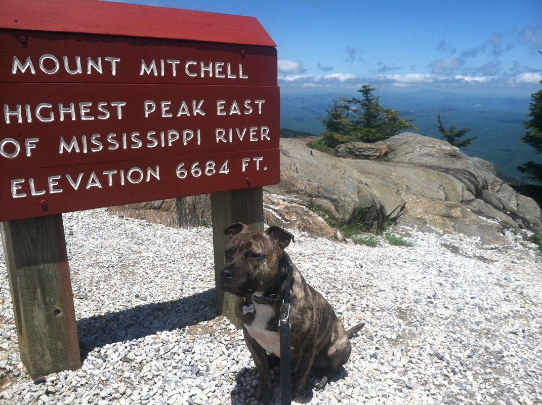
I have no idea how they reached this opinion. Of course I was biased, having just completed Mount Mitchell and had already deemed that the ultimate hiking destination for dogs and for myself.

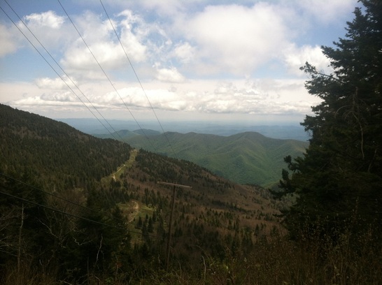
Max Patch is a bit off the map, so one would think it would be pretty deserted. You have to travel at least seven miles on a gravel/dirt path though National Forest to reach it. So, I was little thrown off by the shear volume of cars scattered along the road before and after the entrance to the area. The parking lot holds only ten cars, as I guess the Forest Service suspected as I did, that few people would venture out for this.
Picture
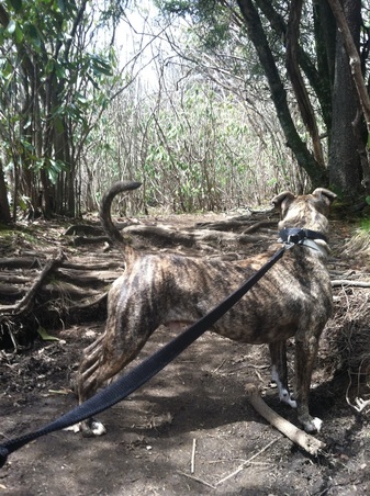
The instructions I received for combining the “around the hill” and “up the hill” trail was to take the trail to the left upon arrival to the sign. However, there were three options. Right, left and left-left. The left trail was most busy, but it headed straight up the grassy knoll. It also stated on a pole “trail closed.” But when it’s just one big green lawn, how do you close a trail? Not being able to see where the left-left trail went to, Tucker and I started up the middle one, even though I was pretty sure we had chosen incorrectly. Mainly because the trail we were supposed to be on was described as being able to avoid the winds that you encounter if you go straight up the hill.

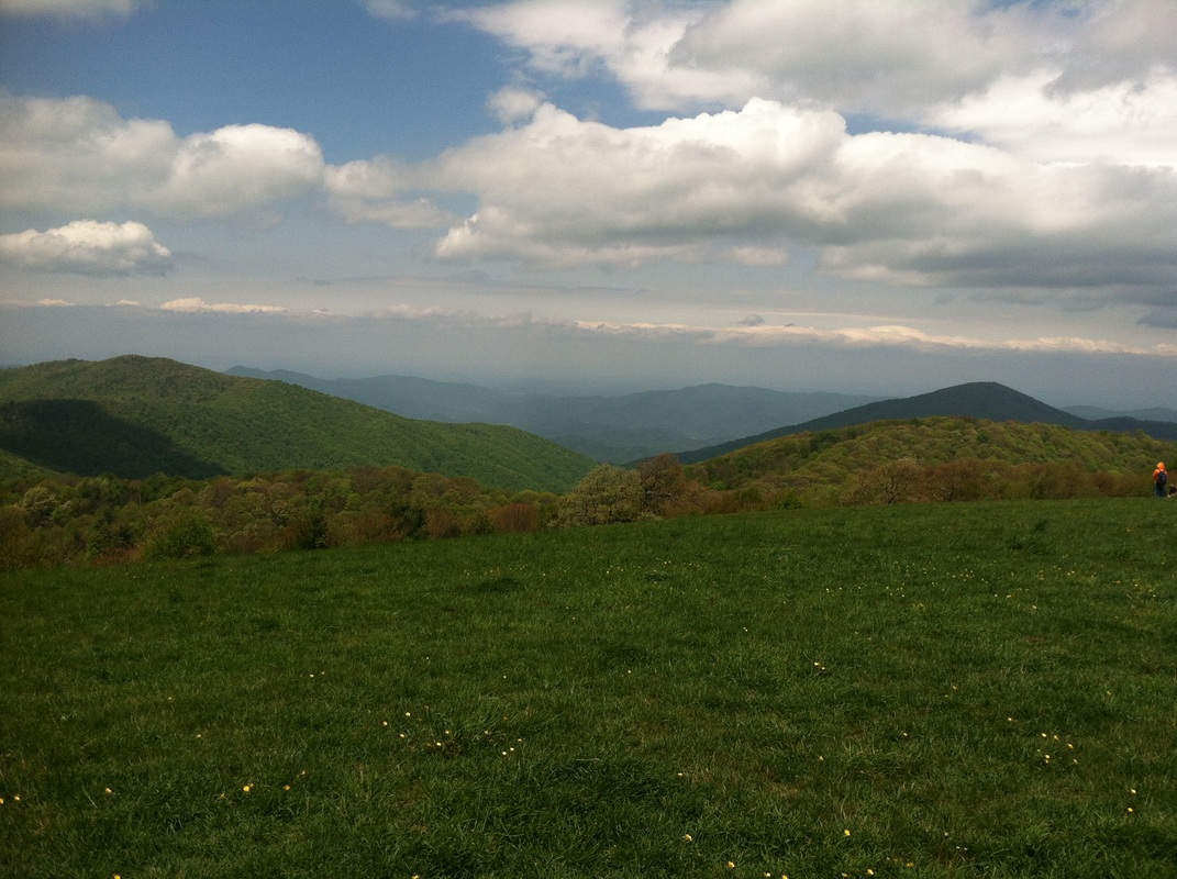
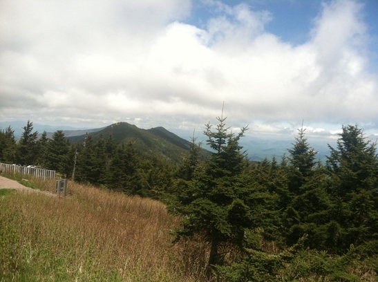
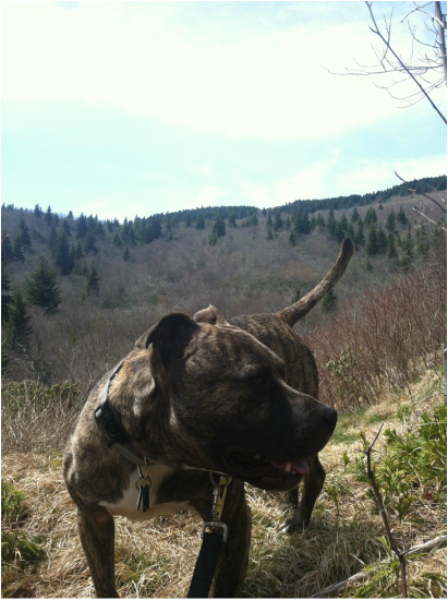
Various sites and books which featured Max Patch told of people coming to this spot to picnic and play frisbee. Again, not sure where these stories came from, but they seem to be something of a rural legend. Tucker and I reached the first cross-trail, and encountered winds strong enough to blow Tucker’s ears almost clear off his head.
Picture
Someone nearby attempted to toss a frisbee, but when he simultaneously lost his ballcap and was violently struck in the chest with the frisbee catching a cross-wind and returning to him like a boomerang, he gave up.

Tucker and I took the trail to the left and further down the hill we met up with that left-left trail we hadn’t taken to begin with. It wasn’t as though we’d be getting lost—it was one big open space—so it wasn’t too much of a loss. I decided we’d take that way upon our return.

Picture
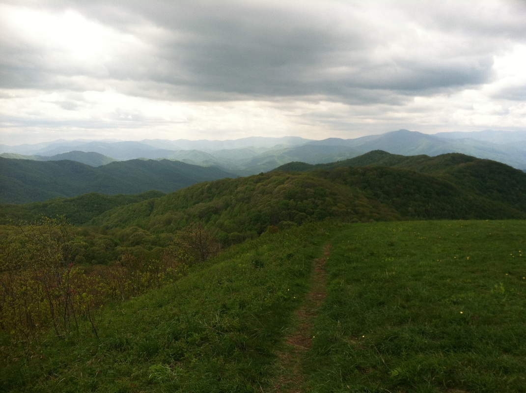
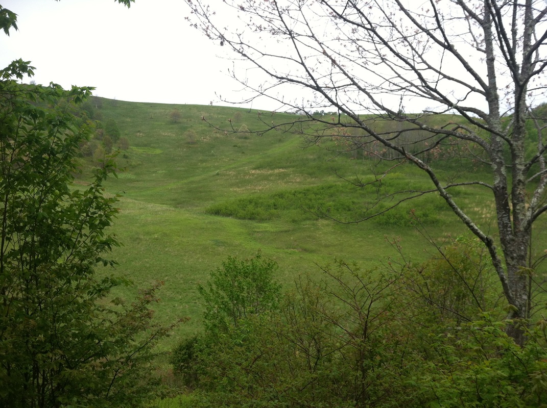
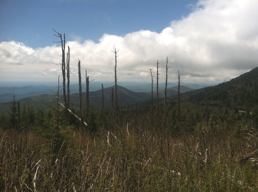
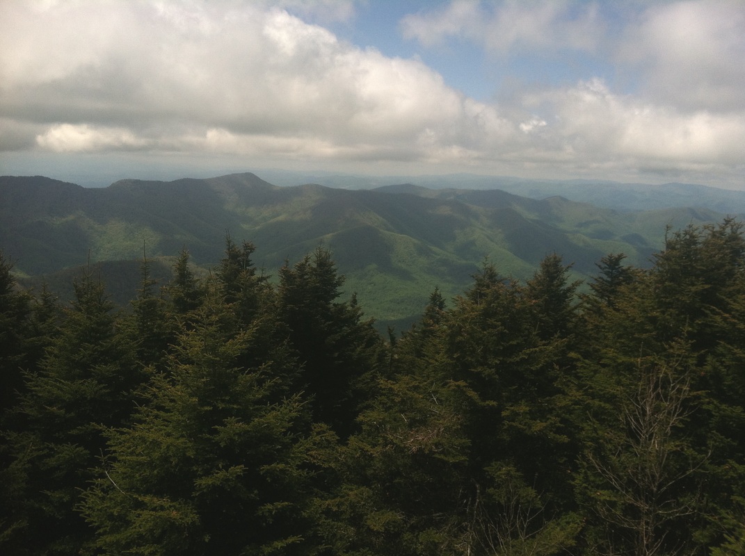
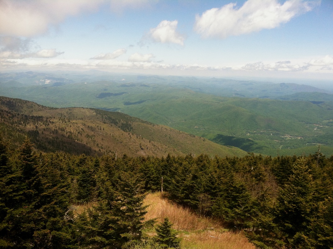
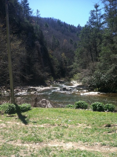
Aside from the annoying windy conditions, it was a beautiful area of rolling hills.
Picture
Picture
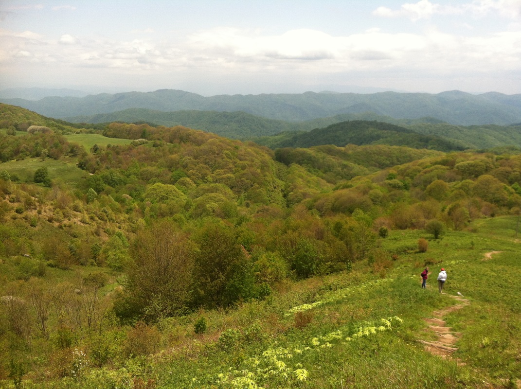
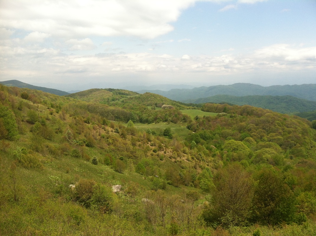
I imagine this is what some places in Ireland look like, although I’ve never been there.
Picture
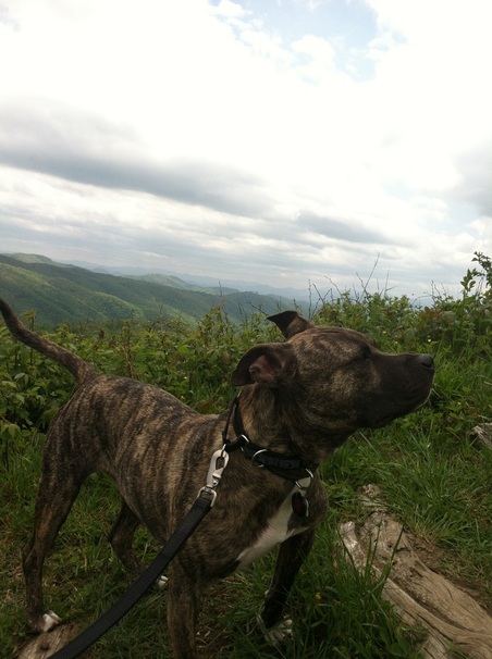
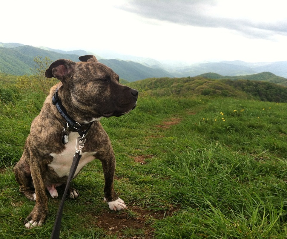
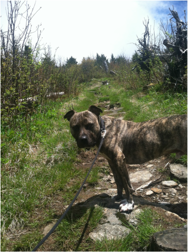
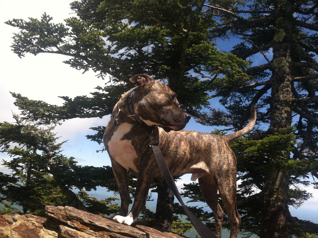
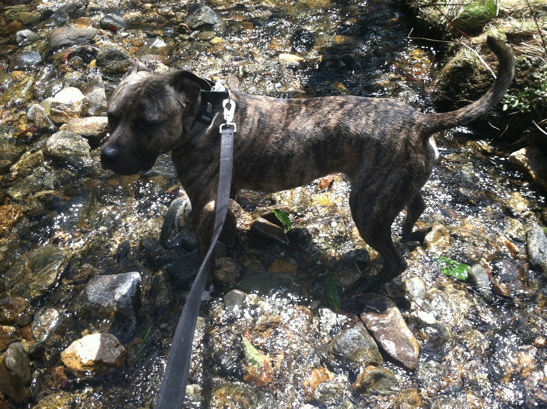
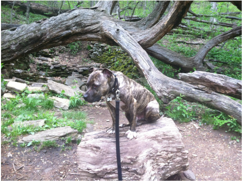
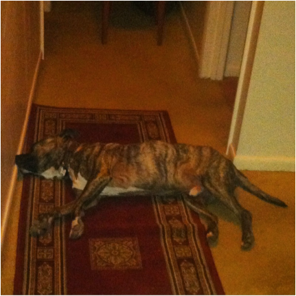
Tucker and I did the full 3.5 mile hike and then some as we got a little lost (not lost, just confused on which path we were supposed to take to stay on course.) I don’t think it was worth the drive, but in the end, Tucker and I got some exercise, some extra oxygen shoved into our lungs, and most importantly, we captured Tucker’s his new album cover:
Picture
0 Comments

Rising to the Peak

5/29/2016

0 Comments

 
When looking for new hikes, I tend to avoid one marked “strenuous” or “difficult.” I’m not the most in-shape person, and I err on the side of caution when it comes to my physical limitations. If the elevation map shows a ridiculously high peak, I continue turning pages. But I really wanted to hike to Mount Mitchell, the highest peak on the east coast. Perhaps the trick was to simply not start at sea level.

Like many trails and points of interest, Mount Mitchell is along the Blue Ridge Parkway. You could, should you really not want to hike, park near the concession stand in the parking lot, grab a bottle of water and a Snickers Bar, and walk .2 miles up a sloped, paved sidewalk to the top.

That didn’t seem like much fun to me.

Old Mitchell Trail is listed as a strenuous 3 hour hike. However, the elevation gain is only 580 feet. Coming from California, that’s just a small hill. The entire area though sits at over 6000 feet. The description of it being more like the climate of Canada than the Southern Appalachian Mountains seemed accurate even though I’ve never been to Canada.

Upon arrival to the park office, I found only two other vehicles, so I was glad it wouldn’t be tourist-filled. Nor did I think it would be given that it was about twenty degrees cooler here than down below, and it was listed as a "strenuous" hike. There was a beautiful chilly breeze, and the air was filled with a fog that you could see the tiny droplets of mist dancing in the wind.

Tucker and I walked across the parking lot to the entrance of the trail and found this:

Picture
If I could be in love with a trail, it was with this one. So often “trails” consist of five foot wide dirt pathways, or the opposite—one foot wide dried-up streambed-like paths that are a foot and and a half deep. This, now this, was a trail.  Even through the meadow, it kept its character of rocky terrain while not being overwhelming.
Picture
Not only was this trail primal nature, but those who cared for the trails made it impossible to get lost. In all my hiking, these are the very best signs at trail crossings that I have ever encountered.
Picture
Once beyond the colorful signs—and a cafe in a field (which you could easily drive to via the Parkway, but coming upon it on foot is a little jarring), you were once more back in nature.
Picture
The views were stunning. And I hadn’t even reached the top yet.
Picture
Picture
Picture
This trail was the perfect mix of open views and cozy forest trails. Tucker and I had to crawl across boulders, climb over giant roots, and rock-hop across streams. (Pictures were not taken of these moments as I was too busy making sure neither of us plummeted to our death or got wedged between rocks.)

We emerged from the trail about half way up that aforementioned .2 paved pathway to the peak, I with muddy pants, hair askew half-tucked under a dirty hat, and covered in sweat, and both Tucker and me panting from the especially steep grade that was the final quarter mile. As I stood a moment to catch my breath, I heard a woman on the paved path say in an exasperated tone, “They said it was 300 yards, but not 300 yards straight up hill! Geez!” Then she came around the corner and saw me. In her mind, the vision of me probably proved her point, although she couldn’t work out why my pant legs were wet.

Tucker and I continued to the top where our muddy, delightful journey was rewarded with 360 degree views of the Appalachian Mountains.
Picture
Picture
I looked across and spied the cafe that we had walked by and was astounded by how far we really had hiked. [Center of picture, follow the winding path--the parkway--to the building and that was our half-way point.]
Picture
Tucker enjoyed the view as well.
Picture
He sat on North Carolina.
Picture
And became king of the mountain.
Picture
Sometimes it hits me where we are and how far we’ve come. And I don’t just mean when it’s indicated on a post-it note.
Picture
I think about Tucker’s previous life, and how long he sat in that shelter. And how so many like him never make it out. Three thousand miles from where we stood on this peak, Tucker almost lost his life because people thought he was “unwanted” and didn’t deserve to live. When really, all he wanted was to really, truly live.

Tucker, I hope I’m giving you that opportunity to really, truly live. Even if you have to put up with me taking pictures of you in all the super cool places our journey of life together takes us.
Picture
Thank you for reaching the peak with me. Don’t worry: this isn’t the last one; there are many more summits to climb. I promise.
0 Comments

Spring Adventures

5/29/2016

0 Comments

 
In the past 2 months, Tucker and I have been so busy exploring the mountains surrounding our little valley town of Asheville, we haven’t had any time to set it down in pictures. Okay, let’s be honest, it’s not the exploring that took away from laptop time—it was the napping after the hikes that did. But admittedly, most have been rather uneventful and not worth more than a photo each.

So here’s a summation of a few of the places that caused nap-time, not write-time since Easter:

Laurel River was a lovely, easy walk along Laurel Creek where in order to see it meet up with the French Broad Rover, we’d end up on the other end of the tracks.
Picture
I enjoyed the brief Stand By Me moment staring down the tracks...
Picture
... but otherwise it was just a lovely stroll along a creek through the woods.
Picture
The next weekend, we took to Graveyards Fields, which gets busy in the high season so I wanted to so it now while it was empty. We walked along trails that took us through tunnels...
Picture
and fields...
Picture
across streams...
Picture
and to waterfalls.
Picture
I know Tucker enjoys the journey, but perhaps he's just a little sick of the photo-ops. At least, that's what I get from looks like this that say, "Really, woman? You, me, water, nature. We do this every weekend. I don't think you need yet another photo of it."
Picture
Then there was Rattlesnake Lodge, whose story is much more interesting than the site itself—or what remains of it.  A man built an entire summer estate for him and his family in the middle of the woods--purposely so that no one could get horses up the pathways there, but you had to walk. Over a mile. Through the woods. If you wanted to visit him and his family and partake of their expansive property which included a pool, tennis courts, and guest houses, you had to really want it.

There are even boulders to make sure nothing too wide could get through.
Picture
Little remains of the lodge. Just a few stone corners and some rubble in the middle. This is where the "Spring House" stood--a building that surrounded a tiny spring that bubbled up clear water all year round. Perhaps the falling tree smashed it to bits--I don't know. Tucker was unimpressed.
Picture
In the end though, it was a tiring enough day for him that he fell short of making it to the bedroom by about two and a half feet.
Picture
The journey is the destination, but a tuckered-out Tucker is an additional reward for the experience of wandering through nature's beauty.

Every weekend--barring rain or laziness (on my part, not Tucker's), we've been out in the woods. This was just a few of our adventures worth noting. Two weeks ago I finally got the courage to believe I could do the strenuous 5 mile round trip up to the highest peak this side of the Mississippi. And that deserves it's own entry. So stay tuned...
0 Comments

    Archives

    January 2022
    December 2021
    November 2021
    October 2021
    September 2021
    January 2021
    April 2020
    March 2020
    January 2020
    December 2019
    November 2019
    July 2019
    June 2019
    May 2019
    April 2019
    March 2019
    February 2019
    January 2019
    December 2018
    October 2018
    August 2018
    July 2018
    June 2018
    April 2018
    March 2018
    February 2018
    December 2017
    November 2017
    October 2017
    August 2017
    July 2017
    June 2017
    May 2017
    April 2017
    January 2017
    December 2016
    July 2016
    June 2016
    May 2016
    March 2016
    January 2016
    May 2015
    February 2015
    December 2014

    Posts

    All
    2016.01.03 Home For The Holidays
    2016.01.04 A Hike On Another Planet
    2016.03.25 Equality Is For Everyone
    2016.03.27 Our Easter Weekend Services
    2016.04.15 Just Des(s)erts
    2016.05.29 Max Patch
    2016.05.29 Rising To The Peak
    2016.05.29 Spring Adventures
    2016.06.11 The Best Of The Unexpected
    2016.06.25 The Ghostly Tale Of Greybeard Trail
    2016.07.03 Escape...to Storyteller Rock
    2016.07.05 A Salute To Asheville From Chimney Rock
    2016.08.15 Up
    2016.10.01 Since You've Been Gone
    2016.12.09 How We Spent Our Summer Vacation
    2016.12.10 Let The Sun Shine In
    2016.12.11 Eyes To The Skies
    2016.12.11 Where The Rainy Day Takes You
    2016.12.18 Waiting For Whistler
    2016.12.31 Only In Canada
    2017.01.10 Christmas On The Coast
    2017.01.11 Christmas On The Coast
    2017.04.22 Out Of The Desert And Into The Land Of Enchantment
    2017.05.05 Someplace To Be; Not Somewhere To Go
    2017.05.20 New Canada
    2017.05.28 Rise To The Challenge
    2017.06.18 Exploring The 'Hood
    2017.06.24 Bishop's Lodge: Anything But Heavenly
    2017.07.01 Finding Your Church
    2017.07.08 Mother Nature's Springs
    2017.07.22 Beside Every Great Woman
    2017.10.15 Finding (Water)Fall(s)
    2017.10.28 This Is 40... Part I
    2017.10.29 This Is 40... Part II
    2017.11.18 Battle Amidst Beauty
    2017.11.25 To The Looking Glass
    2018.02.25 Where The Dog Takes You
    2018.03.31 After The Rains
    2018.04.14 Truly Home Again
    2018.06.02 Just A Walk On The Beach
    2018.07.21 Ready? On Set!
    2018.08.04 Return To The Redwoods
    2018.08.11 Return To The Redwoods
    2018.10.27 The Forty-First
    2018.12.15 The End Of The Tour
    2018.12.30 Santa Cruz
    2019.01.05 Chasing Mavericks
    2019.01.20 Finding Your Soulspace
    2019.02.09 Muir Magic
    2019.02.23 The Point Of Point Reyes
    2019.02.25 From Muir To Mori
    2019.03.02 Our Own Monterey
    2019.03.09 An Irish Escape
    2019.03.16 Hidden Vistas
    2019.04.06 Our Life: The Carnival
    2019.04.20 One Man's Trash Is Another Dog's Art
    2019.05.04 Black Rock And Blue Skies
    2019.06.08 Water
    2019.06.15 In Conversation... With Nature
    2019.06.29 Go Tell It On The Mountain
    2019.07.06 Not So Yosemite
    2019.07.07 Magic Chimneys
    2019.07.20 The Long Way Around
    2019.11.23 All Trails Lead Here
    2019.11.30 Seeking Solitude In All Directions
    2019.12.14 Forest Friends And Soul-Places
    2019.12.21 The San Franciscan Canine
    2019.12.26 An Unexpected Christmas
    2020.01.11 Kicking Off The New Year On The Coast: Part I
    2020.01.12 Kicking Off The New Year On The Coast: Part II
    2020.01.12 Kicking Off The New Year On The Coast: Part III
    2020.01.19 From The Beach To The Bay... Almost
    2020.03.01 Livin' La Vida Local (SF Style)
    2020.03.20 A Place In Which To Shelter
    2020.03.23 Socially Distant
    2020.03.26 Shelter Of Majestic Beauty
    2020.03.28 Follow Your Heart
    2020.04.04 South For The Spring
    2020.04.21 Finding The Way Back
    2020.05.11 First Rate Second Choice
    2020.05.30 Trails Worth Taking
    2020.07.15 A Reflection Of The Bay
    2020.07.22 A Quarter Of The Way To Half Moon Bay
    2020.10.10 Mountain Air
    2020.11.21 The Great Donut Drive
    2020.11.26 Holiday Special
    2020.12.21 The Great Conjunction
    2020.12.25 The Magic In Every Day
    2020.12.31 Some Other Beginning's End
    2021.09.12 The Oregon Trail
    2021.09.18 Reaching The Summit
    2021.09.26 In Light Of Grey Skies
    2021.10.03 Adventures Need Not Be Far
    20211010-from-the-sea-to-the-mountain
    2021.10.10 From The Sea To The Mountains
    2021.10.16 One Beaut Of A Butte
    2021.10.23 Birthday Falls
    2021.10.31 Where Angels Rest
    2021.11.07 Where Falcons Soar
    2021.11.14 To The End Of The Road... Or Island
    2021.11.20 Reflections
    2021.11.28 Giving Thanks To Mother Nature
    2021.12.05 The Journey Of The Falls
    2021.12.18 Right Here
    2021.12.26 The Magic Of Any Day
    2022.01.03 Taking Our Leave... Maybe
    2022.01.04 Beaches And Bluffs To The Redwood Forest
    2022.01.06 The City By The Bay... And Beyond
    And Away
    But Not Far Away
    Comes The (Water)Fall
    Everywhere
    Maximum Wind Speed
    Nose To The Wind
    Not Out There
    Not The Map
    Part I
    Part II
    Santa Clause
    Santa Paws
    The Look Of Discrimination
    The South's Answer To The Southwest
    Tucker Wescott: Interior Designer
    Up
    Water

    RSS Feed

About    Contact   
c 2014 August Nights Press