It's a Pittie-full Life
  • Home
  • Travels with Tucker
  • Is it Tucker-Tough?
  • Precious Cargo
  • Renovating Rover
  • Tucker's Favorite Folks

Travels with Tucker

I'm not John Steinbeck and Tucker is certainly no Charley. But after our first year together travelling over 14,000 miles, criss-crossing America, hitting 17 states, I thought it was about time we started documenting our adventures.

Rise to the Challenge

5/28/2017

0 Comments

 
With a rare three day weekend ahead, I considered staying in Taos, NM to go exploring. Thursday afternoon, however, someone told me of a delightful little trail called San Antonio Springs. It is 11.4 miles (more than Tucker and I have ever done in a day), but the elevation gain isn’t bad, and the whole point is to walk 5 miles, hang out for an hour or two in the hot springs, and then return. It would be challenging, but if the weather was cool, there was some shade and very little elevation changes, it was doable.

Both of these adventure options involved getting up early Friday morning. 

So neither of them happened.

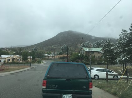
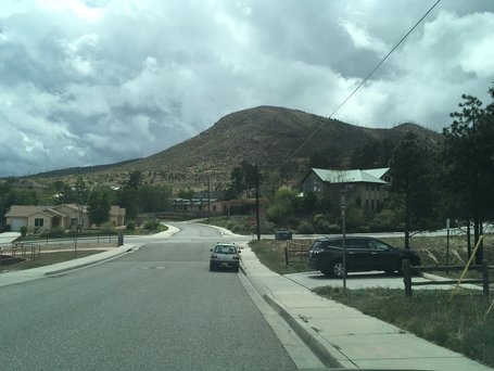
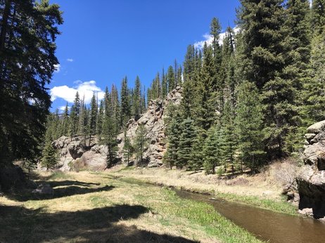
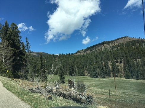
​I had some business to attend to that I wanted to get done before the droves of tourists arrived in town, so I did some practical shopping and opted to give Hyde Memorial Park a try for a hike. I had driven through on our way to another hike a couple weeks ago, and it was just a twenty minute drive away. Both Taos and San Antonio Springs would involve almost two hours in the car each way.

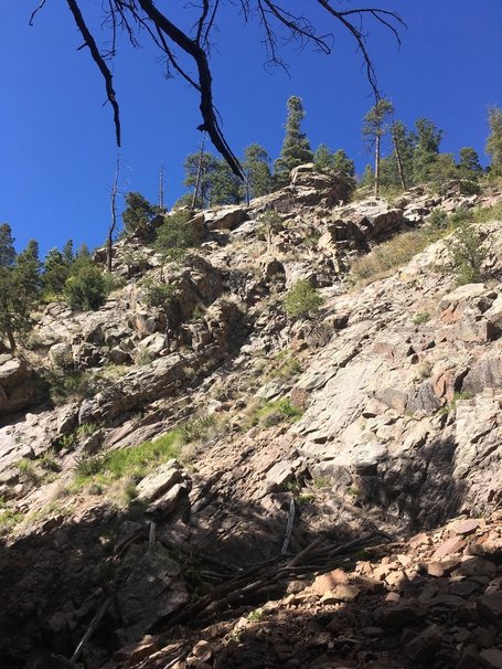
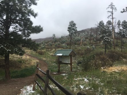
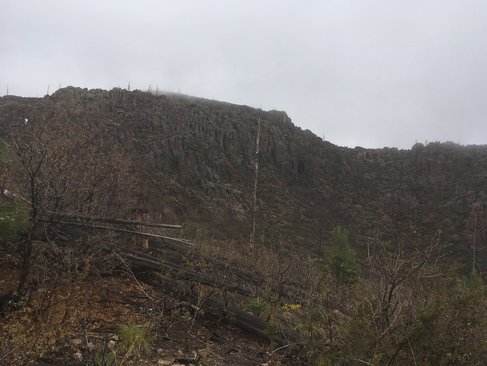
The only issue with the Hyde Park trail was the elevation. AllTrails described it as a 2.8 “moderate” hike. The Hyde Park visitor center rated it as “hard” because although it was super short, the elevation gain was 1125 feet… in about 1.3 miles. Tucker and I had done Chimney Rock in North Carolina, which is 499 stairs, but is only about a 500 foot elevation gain. This would definitely be a challenge. 

People in my office had ben suggesting hikes for me, all of which were either over 10 miles or over 1100 feet in elevation change. I told them I’m not all that physically fit and although I probably could walk 12 miles on flat ground without stopping with no problem, the elevation gain kills me. I’m just not in shape for that—and the hikes are already located about 8000 feet above what I’m used to living in Southern California.

But I decided to try anyway.

And once I try, I can’t fail. I won’t let myself. That’s not to say it is without its difficulties. But I refuse to give up once I start something.

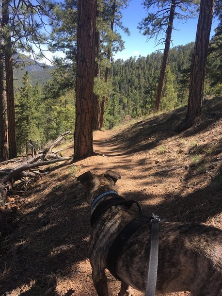
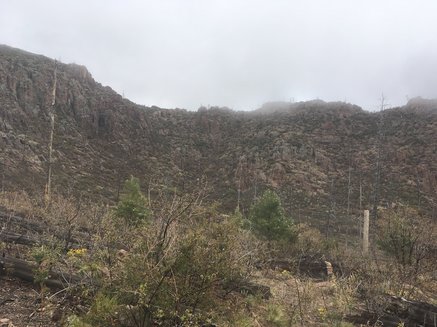
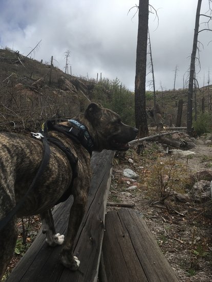
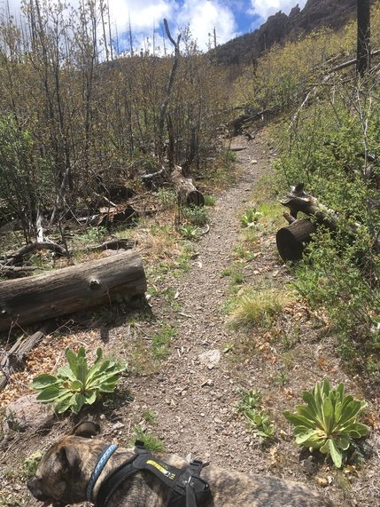
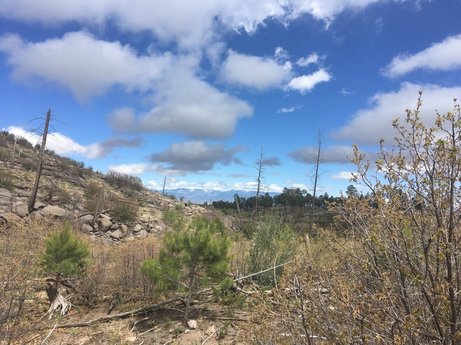
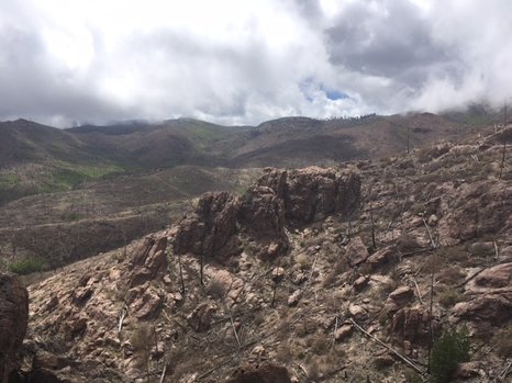
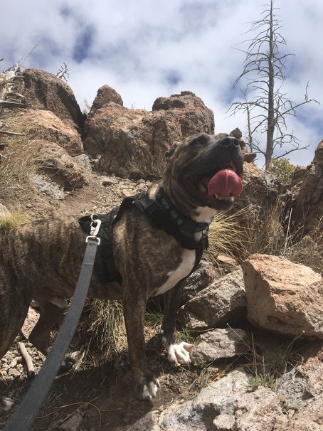
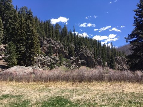
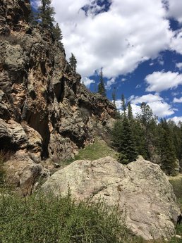
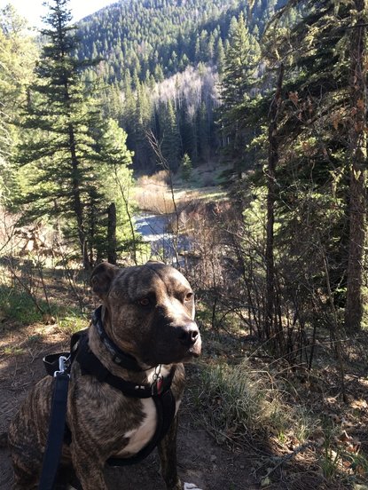
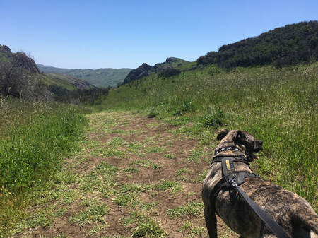
Within five minutes we were already well above the road that had brought us there.
Picture
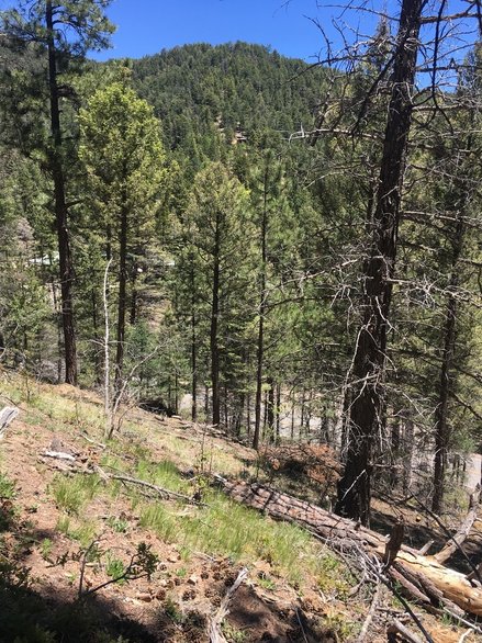
I remembered what a friend of mine told me almost a decade ago the first time I went on the walk in Griffith Park from the merry-go-round to the helipad: “Don’t look up. Just keep your eyes on your feet and you won’t notice how steep it is.”

I tried to keep her advice in mind, even though the Griffith Park walk is only about 300 foot elevation change over a mile. This was four times that.
Picture
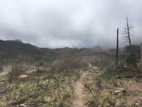
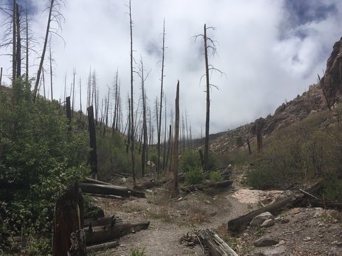
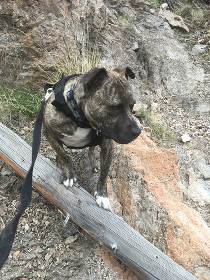
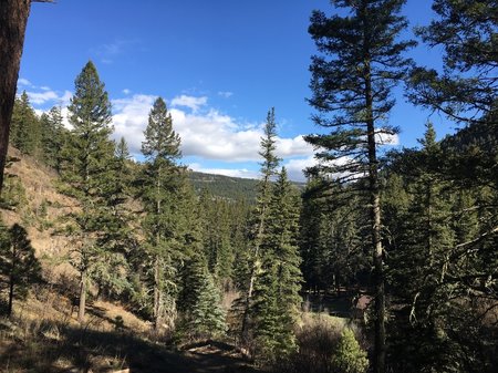
​I was also reminded of my first hike in Purisma Creek Open Space off Skyline Blvd. I went down just fine, but on the way back up, I thought I might not make it. It was pre-Tucker days, so it was just me and the woods. I took stock: one granola bar, 16 ounces of water, and a flashlight. I might have to stay the night. I was in much better shape back then, and I just read that the elevation gain is 2900 feet. However, that’s from sea level. When you already are in the upper atmosphere, it’s a little more difficult. Oxygen molecules are scarce. And strangely, despite the abundance of trees all around, there was very little shade.
Picture
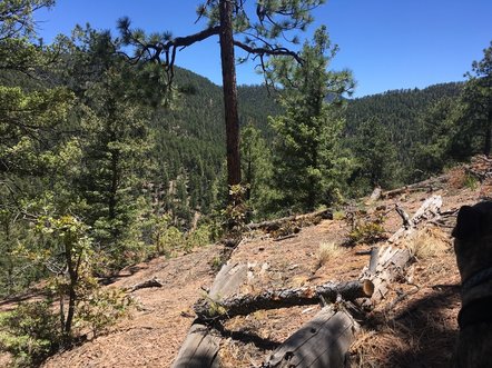
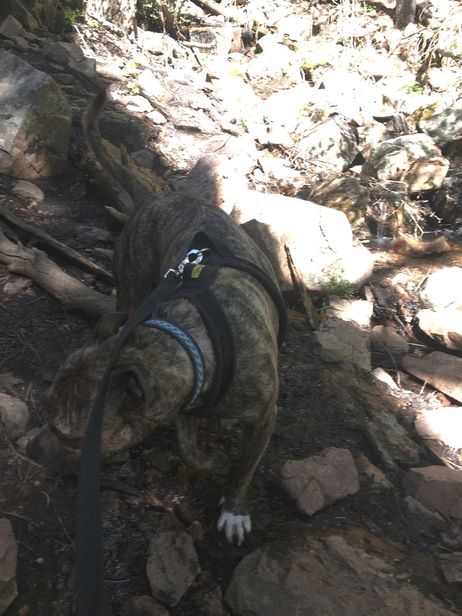
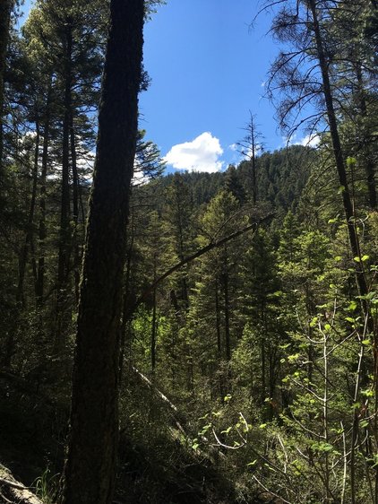
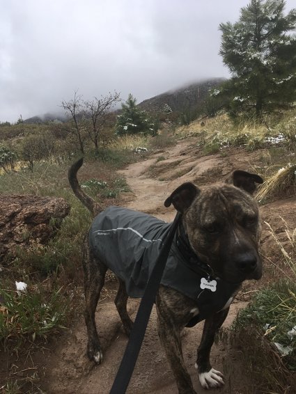
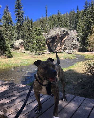
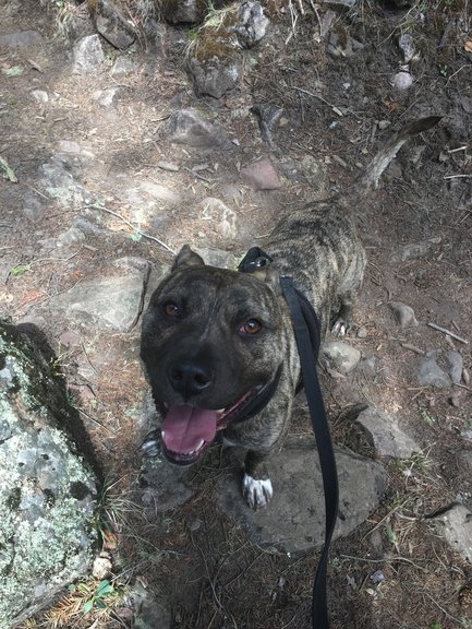
​The strategy became just to get from one shady spot to another. I don’t know how exhausted Tucker was, but I feel like being closer to the ground on all fours would be less of a steep climb. Being a biped is extremely inefficient.
Picture
One of the cardinal rules, including when I was making my way up Purisma Creek, is to Never. Sit. Down. It’s just a bad idea. Keep your legs moving, and keep your blood pumping. Don’t sit down. 

But in this case, I abandoned my rule.

I abandoned my rule five times as a matter of fact.
​
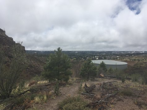
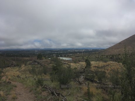
Feeling light-headed, and getting the sense that my legs might start to refuse my requests,  the only thing I could do was sit down on the trail. The upside was that it gave me a chance to check out the view.
Picture
Picture
Picture
I was severely disappointed in myself and angry that my body wasn’t up for the task.
And slightly annoyed that two of the times I sat down, when I got up, I discovered that we were around the bend from an actual bench placed there for unfit hikers such as myself.

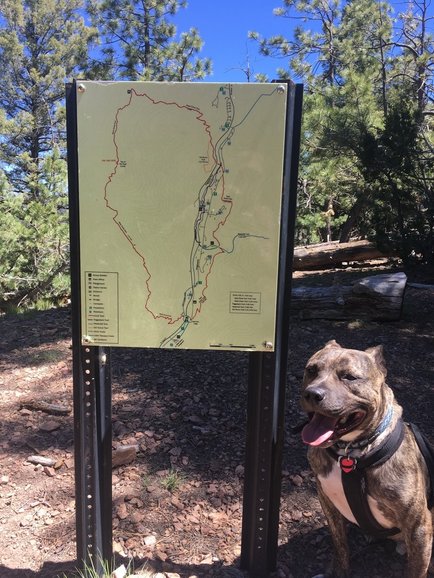
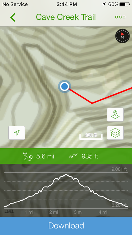
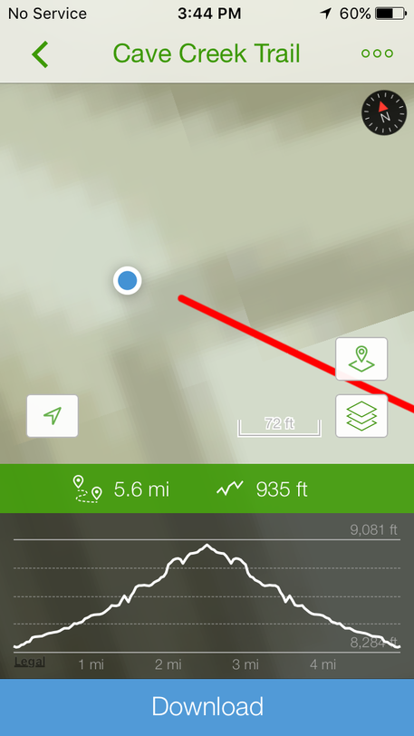
I’ve only recently started using AllTrails, and in some ways, it’s not useful. Now I get to check in on how far along I am and how much farther I have to go. Before, I just set my feet on the trail and went until I could go no longer. There was no status updates. Knowing how far you have to go adds a different level to the hiking experience: like major disappointment when you’re not as far up the red line a you thought you were.
​
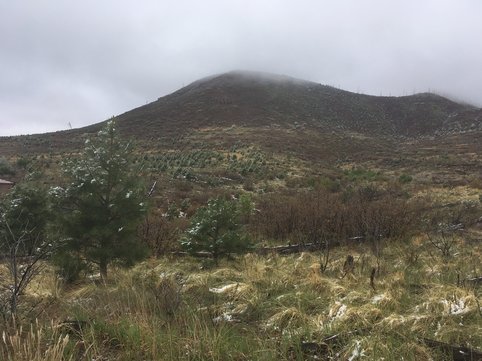
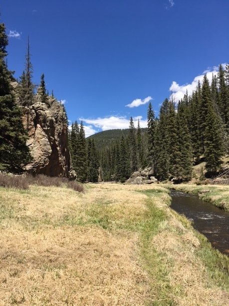
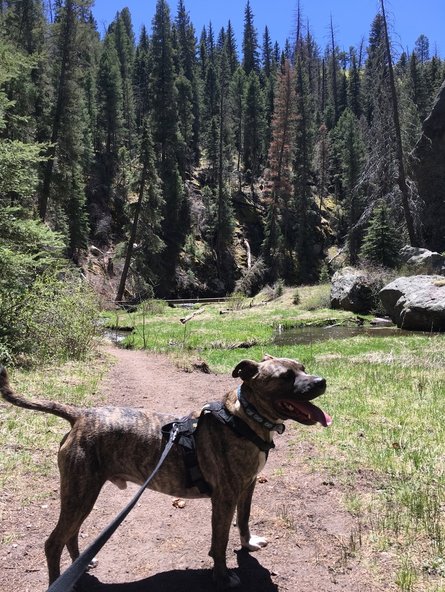
We did eventually get there:
Picture
Picture
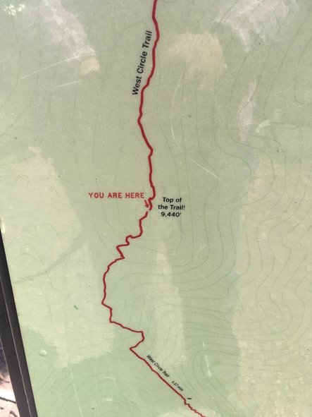
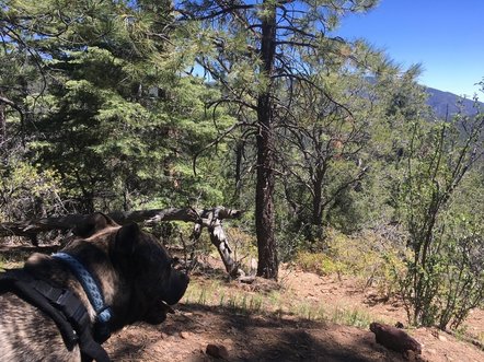
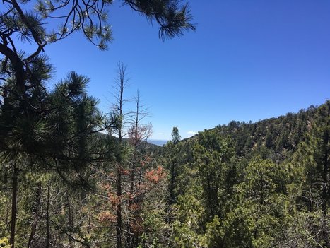
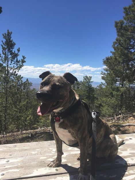
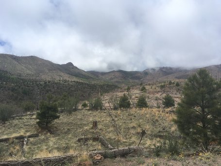
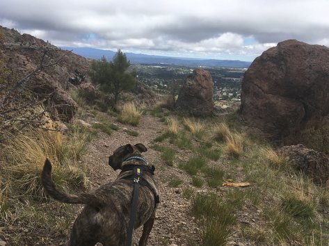
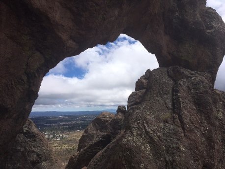
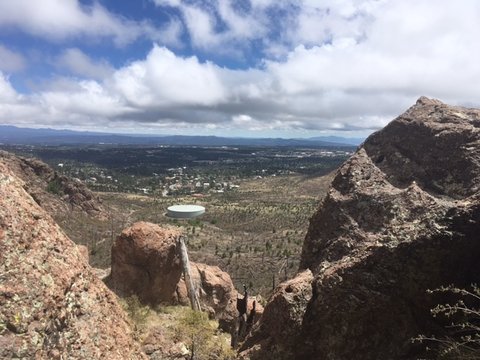
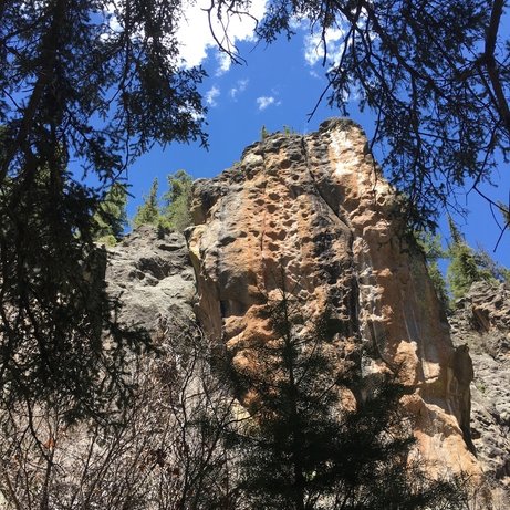
However, the only grand sight to see was this sign proclaiming our success. We walked on a little further to the picnic tables, which was a few feet below 9440 feet, and there we found the view.
Picture
We enjoyed the moment and the view (and a manmade product for sitting), and then down we went on just as steep a descent as it was an ascent on the west side of the loop.
Picture
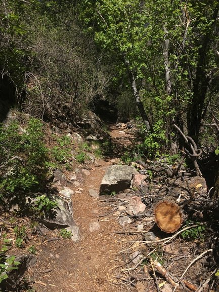
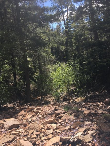
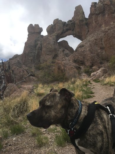
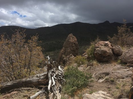
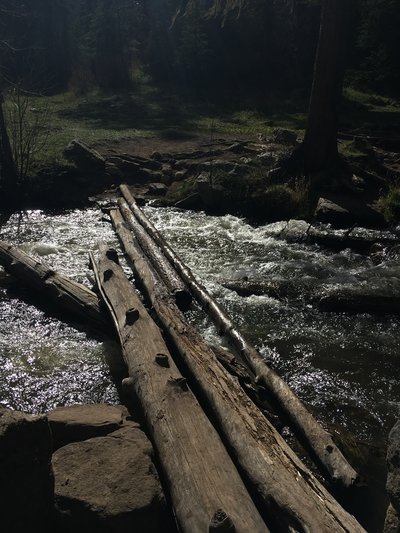
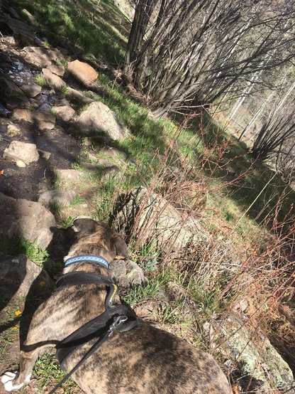
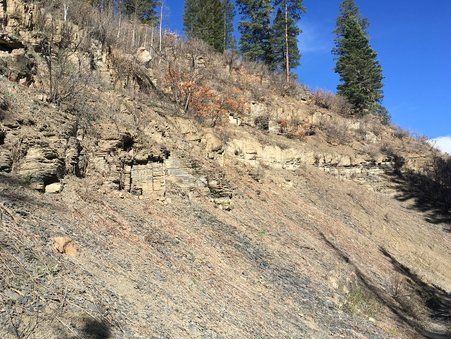
Although the trail was a bit softer in most places being under the conifers, there were still large sections where the chosen texture was broken up pieces of shale. Not my first choice. Or even in the top ten options. It has a great tendency to slide along with your boots.  At one point I considered doing what I had done on the Canadian ice trail: just sit down and slide my way downhill. However, ice is a far more forgiving way of travel than rocks and pinecones to cushion your ride.
​
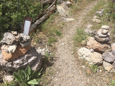
I got off trail a little as the AllTrails didn’t follow the East Circle trail, but took the easy Piggyback trail for a spell. I agreed as my legs were feeling a little rubbery and I was feeling a little cranky. Nature shouldn’t make me cranky. Nature is the de-cranker of my life. 
Picture
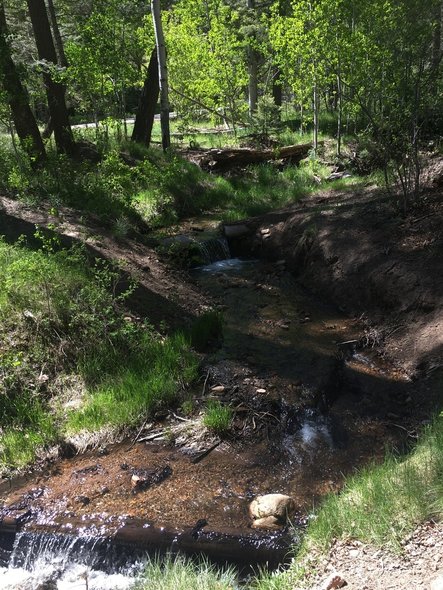
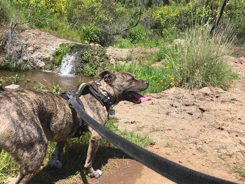
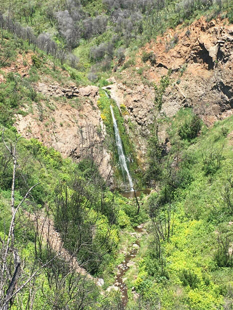
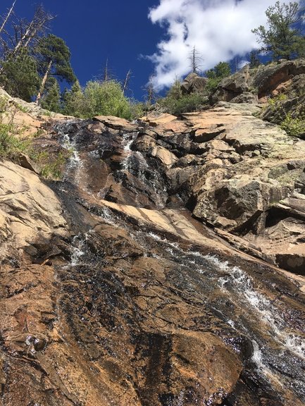
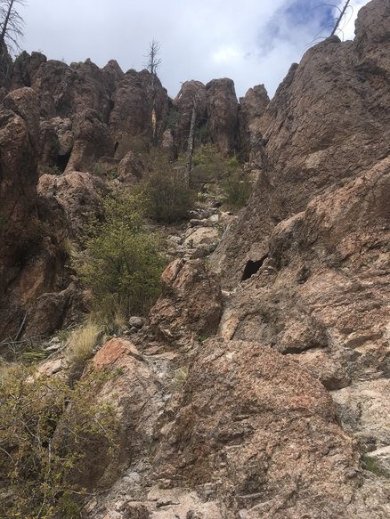
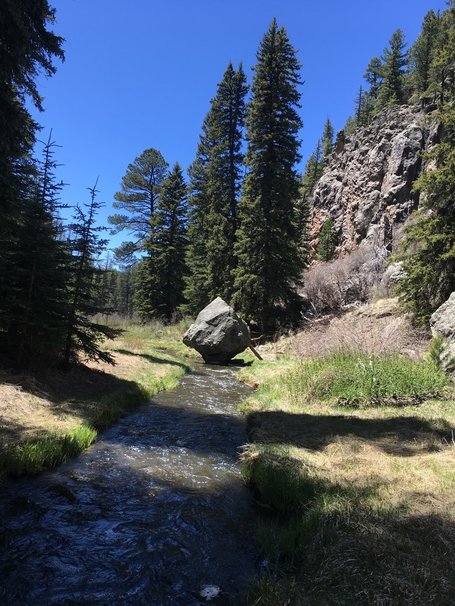
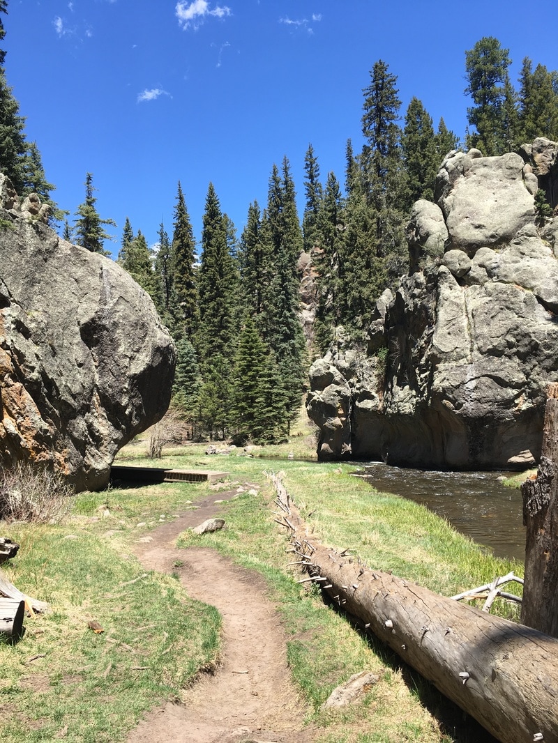
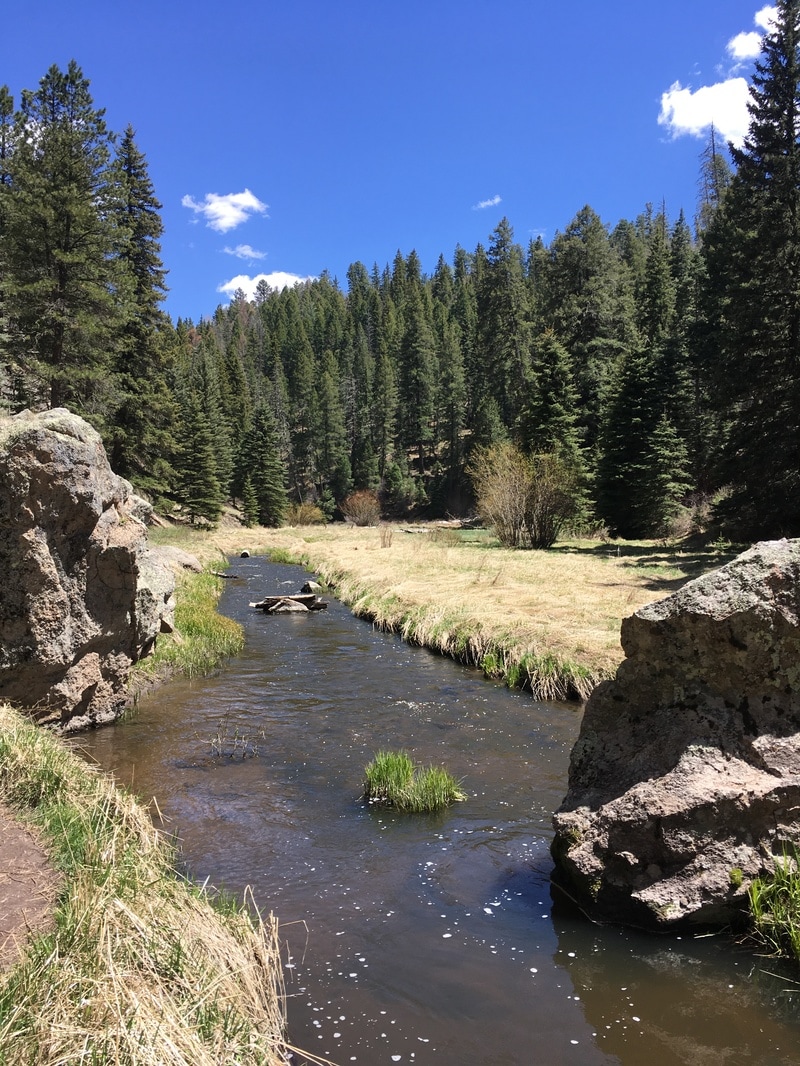
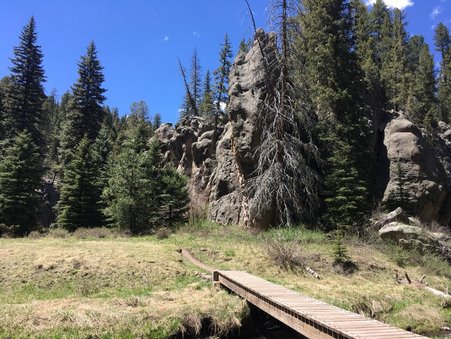
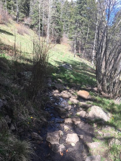
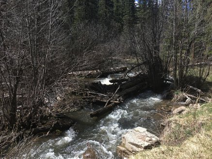
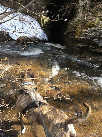
​So we walked an easy trail along the creek for a short spell, then, because I didn’t want to leave being in a fouler mood than when I had arrived, I opted to take the Waterfall Trail. Slightly annoyed with the trail maps, I finally found it, changed my perspective, and up we went.
Picture
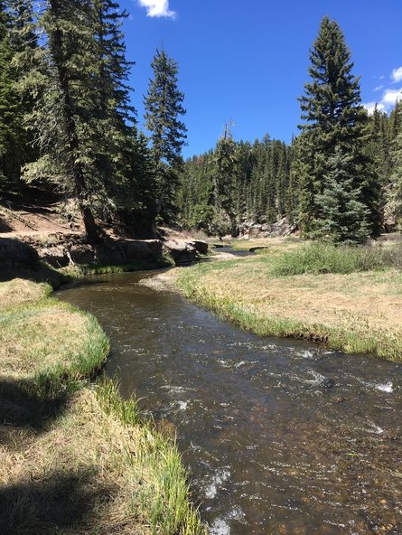
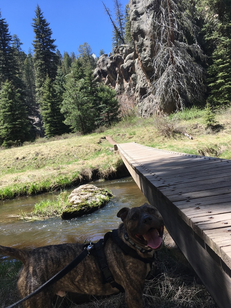
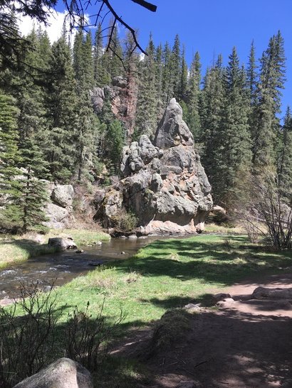
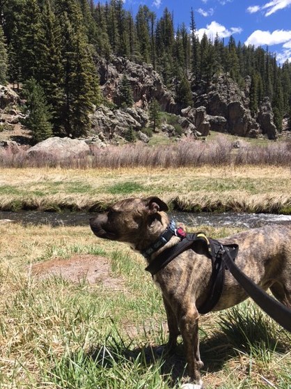
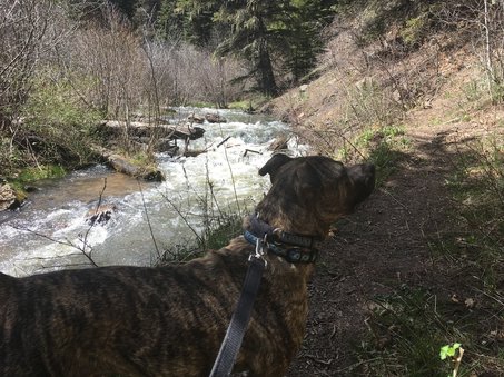
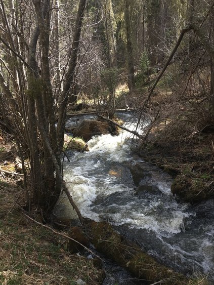
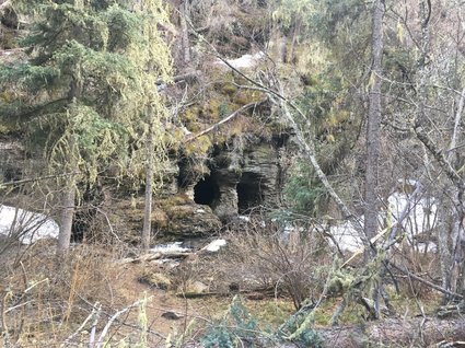
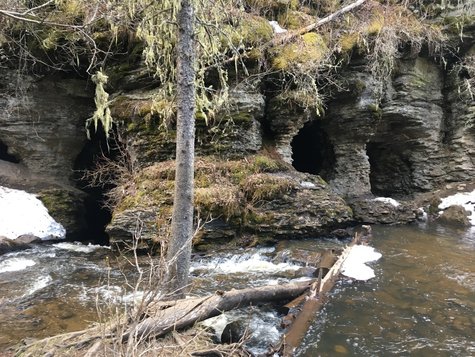
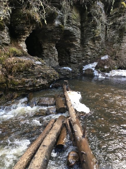
​The water here must not be too slimy, because unlike many rocky waterbeds I’ve been to, these rocks were not slippery. Which was a very good thing, since the entire waterfall area was rocks.
Picture
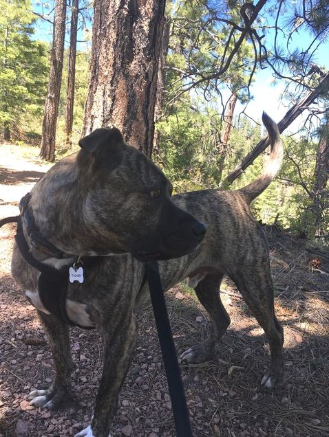
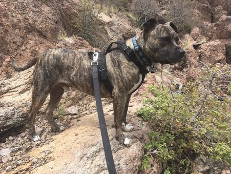
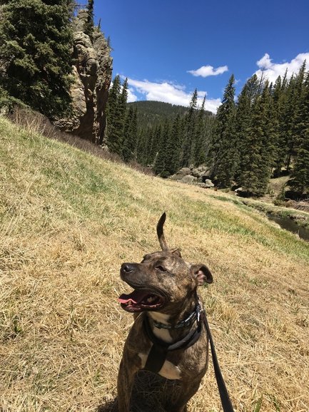
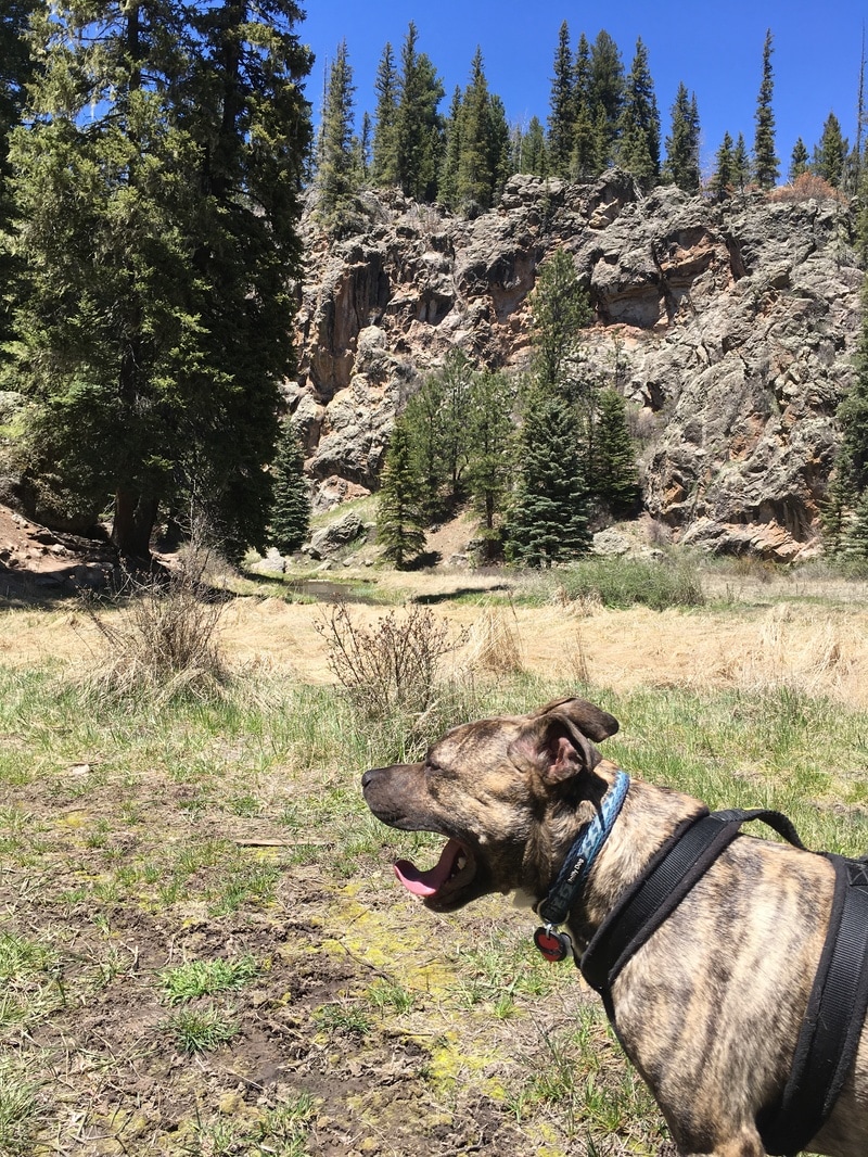
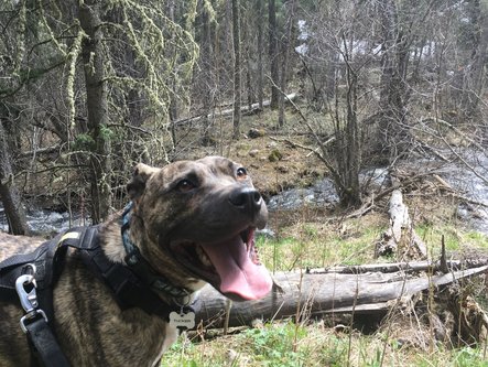
​Tucker and I enjoyed the cool breeze and the freezing cold water.
Picture
Picture
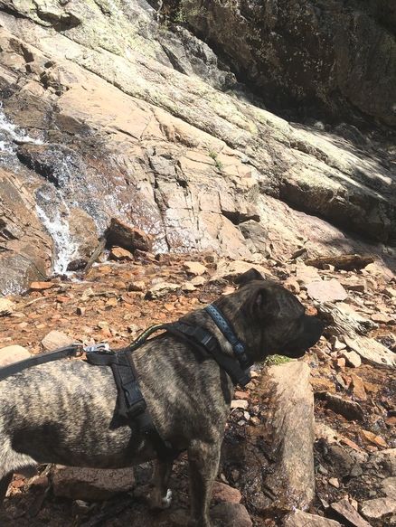
​Tucker even wanted to try to get to the top of the waterfall, but I didn’t see how we’d get up and back down safely. In fact, while standing at the bottom of the waterfall, I contemplated how we would get back down without cracking our heads open or breaking a toe.
Picture
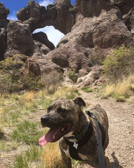
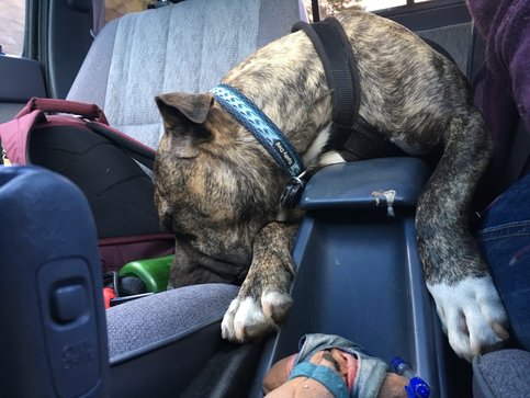
​Water is life, and the waterfall brought back the joy of living for me. My earlier issues with oxygen and my body not being everything I want it to be, was washed away. Tucker and I were just enjoying being again in a little pocket of paradise.
Picture
​The rest of the way back, I kept that little bit of paradise in my own pocket. It is the reason I hike: to get away from all the society’s needs and wants, and just go back to the basics. It makes me.. well, me again.
Picture
Although I don't advise myself to take on another such steep climb in the near future, I do advise myself to get healthier so I can one day. Little pockets of paradise are usually off the beaten path, up in the mountains, where only those pure in spirit and strong of body can reach. Tucker is already both. And I don't want him to miss out experiencing a single one of them.
Picture
0 Comments

New Canada

5/20/2017

1 Comment

 
The Natural Arch via Old Mitchell Trail is rated as moderate. It’s only 1.8 miles, and from the reviews on AllTrails, it seemed like an easy trail, only 584 foot elevation gain and just a mild “scramble to the top.” Upon getting to this area of “scrambling,” I came to the conclusion that this hike must have been rated by Canadians. Their version of “easy” involves only one rope climb wherein you have to strap your dog to your back. “Moderate” is reserved for more difficult chutes and ladders to get to your destination.

But it didn’t start out so Canadian moderate. In fact, it was rather American easy, but with a Canadian flair: snow. 

I awoke in the morning to flurries. In May. In New Mexico. It seemed that the storm was passing through, so I waited an hour before starting our journey to Los Alamos in the hopes that we’d get there as the snow died down.
​
Driving through the mountains with  the windshield wipers on, I pondered if I had made the right decision. I sometimes overestimate my New England girl self.  But it was only a little bit of snow… in comparison to Canada.
Picture
​When we arrived at the trailhead which was located in what I consider suburbia, the snow flurries had calmed and all that was left was a few mounds of the white stuff on colder areas of the earth and manmade structures. 
Picture
​Tucker wore his rain jacket for about five minutes. I realized that giving him the extra leeway on the harness was more practical and more fun for him than staying dry. 
Picture
​It didn’t matter anyway: within a few minutes, the clouds ceased their release, and we walked under (and through) overcast skies.
Picture
​I was grateful for the cloud cover and 46 degree weather. Due to the forest fire years ago, there would have been no shade at all if had been a sunny day. As I looked over across the canyons, I wondered how lush and green this place once was, and what an entirely different experience this hike must have been before the fire.
Picture
We reached an intersection of the trail rather quickly, one that was not indicated on my map. I followed the sign in reality rather than the two dimensional line on my phone, and continued on the Mitchell Trail.
​
It wound up onto the hill overlooking the town and gave us sweeping views of the surrounding mountains.
Picture
Picture
Picture
Every time I checked in on the GPS to see how far we were from the right hand turn that would bring us to Natural Arch, I noticed that we were well off the red-marked line my technology was supposed to be guiding us on. I chalked it up to poor GPS locators due to cloudy skies and kept on walking, assuming eventually we’d hit the crossroads. Looking off to the canyon to my right, I didn’t see where this rocky structure might be, nor how the trail we were on would eventually hook up with the little dirt lines I could see from afar.
Picture
​We started to curve down into the canyon itself, and I still hoped that meant that we would reach the trail we needed to be on. The fallen trees offered Tucker some agility practice, so we played a bit in the gravel and ash-laden canyon floor, hopping over the charred remains of trees and climbing over boulders.
Picture
Picture
​We had been walking for over an hour—far longer than it should take for a simple 1.8 mile hike (and that would include the way back as well.) It was hard to discern where the trail was as we got deeper into the canyon, and my fear of a flash flood coming through made me rethink my choice. We obviously had taken a different trail than what we should have. (There is no “wrong turn” in nature—just a different journey to a different destination than you originally planned.) So I retraced our steps, went back up onto the hill and decided to take the turn I hadn’t the first time—the one that led away from Mitchell Trail.
Picture
​Even if we never found the Natural Arch (I still could not fathom where it was despite the sweeping vista we had from what I can only presume is “New Mitchell Trail’), it was still a decent jaunt through nature with some expansive views. 
Picture
We had already clocked in two or three miles of wandering, and when we arrived back at the crossroads, I opted to try our luck on the other path rather than just call it a day. The cool air made for excellent hiking weather, and we weren’t the least bit tired.
​
The path through the canyon was easy enough, and off the path was a natural agility course of fallen trees. I kept Tucker on track and on the lookout for the trail to take us up to the rocks. This time, looking at my GPS, I saw that we were right on the red trail. So there had been no problem with the GPS after all.
Picture
​I came across a subtly marked trail whose metal sign appeared to have been broken off, and decided to give it a try. 
Picture
It was a definite ascent, but not too terrible to begin with. Reviews had advised to be on the lookout for cairns because you could easily lose the trail in the wide open spaces. 

There wasn’t so much wide open spaces, as there was just the same color everywhere. 
Picture
​There were some precarious spots in which I worried that Tucker and I could fall off the edge of the cliffs. I was feeling light-headed from the elevation and felt that little bit of vertigo that sometimes hits me when I’m up high on the edge of something. 
Picture
Then we came to the “scramble” area. I had pictured in my head just a few boulders right near the entrance to the arch. I hadn’t foreseen half an hour of using my brain to find the path of least resistance and using my braun (the little I have), to heft my 60 pound companion up onto boulders and rock formations then figuring out my own way.
​
The agility course Tucker had on the canyon floor was child’s play. This was the real deal. One false move and we’d both come tumbling down. However, I wasn’t thinking about that. I took each obstacle as its own. I only looked at the immediate next few steps, not the ones beyond that. I did espy cairns which helped a little, but even with those, sometimes the best path for a four-footed hiker was a different way. 
Picture
​Our strength-based climb was rewarded much later than I thought it would be—to a small clearing  with the namesake of the trail at the end of the meadow. 
Picture
Picture
​I still could not see where this was from the canyon floor or the rise we had walked on. It was almost as if it only existed if you were wise and strong enough to reach it yourself.
Picture
​By this point, the sun was poking out between clouds, and the heat of the day was starting to rise. Standing in the middle of the arch, a lovely breeze washed away the warmth. 
Picture
​This little secret glen with its sweeping views was worth the climb. 
Picture
We were alone, as we often are. I can’t imagine trying to negotiate and navigate the rocks and boulders if other hikers were around—especially other hikers with dogs.
​
Tucker and I enjoyed the view and the success of reaching our goal for a brief time. I saw storm clouds rolling in, and again visions of a flash food urged me to get back down off the hill as quickly as possible.
Picture
​Getting down was just as hard as getting up. Tucker’s harness proved invaluable as I helped guide him down and to stop him from continuing his descent over the cliff’s edge.
Picture
​I was grateful and thankful for his trust. Not only did I experience the beauty of the land, but the beauty of the bond Tucker and I have: this incredible trust we have in each other. We seldom need to use it, but knowing it’s there made me acknowledge just how deep our relationship is.
Picture
Tucker took in the scents on the way down, stopping every now and again to catch something on the breeze. I don’t claim to know what he experiences on our hikes, but I have a feeling it goes well beyond our human experience of sights and sounds.
Picture
​The snow was completely gone when we arrived back in suburbia. Our New Canadian adventure was yet another example of this Land of Enchantment casting its spells. You’d never know this little glen and window to the world was there if you didn’t know the way and didn’t have the heart to really desire its existence. Whether its the magic of a nook of hidden beauty in the landscape, or the magic of two souls of different species connecting in trust and love, it’s something that exists whether or not you know it; but you’ll only truly experience it once you believe in it.
Picture
1 Comment

Someplace to Be; Not Somewhere to Go

5/9/2017

0 Comments

 
When it comes to hiking, the journey is the destination. The act of walking through Nature is, in and of itself, the entire point. But every now and again there is a place that you don’t want to walk through; you just want to stay.

Such it is with Las Conchas Trail… or as AllTrails.com calls it: Jemez River East Fork Trail.

I had had a whole adventure planned a couple weeks ago for my first real two day weekend. Go southwest and then head north to go through the Gilman Tunnels, stop at the visitor center for some trail maps, then head into the Santa Fe National Forest where Tuck and I would visit Jemez Falls (.7 hike) and then a few miles down the road the 3.5 mile hike of East Fork Trail, then finish the day by heading south along the Taos Highway and stopping at a dog friendly vineyard to walk about and have some wine tastings.
​
But I woke up to this:
Picture
Doesn’t look too bad, but with it changing from snow to rain and back again hovering at the ever-precarious 32 degrees, I didn’t want to risk icy conditions in a mountain range I wasn’t familiar with.
​
The next day was the official “winter weather watch,” and Tucker and I trekked through our neighborhood, reminiscing about Vancouver.
Picture
Picture
Five days of moping indoors while 70 degrees and sunshine melted away the snowstorm, I was ready for take two on my weekend. Before I left work though, my boss showed me some photos of where they had shot earlier that day. He said there was a trail that led down the river and rock-climbing equipment in the rocks. He said it was near the East Fork Trail, so I decided to forego the Tunnels and visitor center portion of my trip and add this little spot of heaven to our planned tracks.
​
Alltrails.com’s directions led us straight to the trailhead for Jemez River East Fork Trail… except this was the sign:
Picture
​It was the trail my boss had showed me photos of the day before. A rose by any other name is still a rose… and this was a garden of them.
Picture
As I said, in some places, it is the hiking that brings the joy. The feel of boots on soft earth, the view along the way—the view around the next bend. But here, something was different. This wasn’t somewhere to go; this was someplace to be. This wasn’t a journey; this was an art gallery: Mother Nature’s Art Gallery.
Picture
​A couple of people climbed the sheer rock faces, but the few other people whose feet were planted on the earth were sitting and just being. I didn’t know where to turn for in every direction was a beauty to behold.
Picture
Unlike an art gallery where you walk from one scene to another, I was in one giant mural. The energy was a blanket of peace and I didn’t want to leave. 
Picture
​We walked because there was a trail to follow, and it did indeed join to the East Fork Trail on a series of switchbacks up the hill. But I chose to stay in the main gallery of art.
Picture
​My pictures do not do it justice. You must go for yourself to experience it fully. There are no words precise enough to describe it; and no amount of pixels could capture the beauty in all its truth. You step into Nature’s Gallery, and you become a part of her work. Every soul’s experience is different, but all are welcome.
Picture
​Tucker and I found joy and peace here. And I hope one day you, too, will come and experience it for yourself. For now, here is a vague reflection of our time in Nature’s Gallery:
Picture
Picture
Picture
Picture
Picture
Picture
Picture
Picture
Picture
Picture
Picture
May you find peace on earth by being in any of Mother Nature's Gallery, and may it leave you with a smile on your face and warmth in your heart wherever you may go.
Picture
0 Comments

Out of the Desert... and into the Land of Enchantment

5/6/2017

0 Comments

 
The desert is a lovely place, but it is not my place. So with a research, I found a hike only an hour away that should satisfy my likings. I hoped that the “Cave Creek Trail” was aptly named and would give us both caves and creeks.

Into the Pecos Wilderness we went, and once close enough, we were officially off the grid. No cell phone service and no internet, so all those people who rely on that stuff to get you to trailheads: it’s not a good idea for this one.

I added a half hour onto our journey due to taking what I thought was the “slight left” the directions spoke of, only to be completely wrong by many miles. I was determined to find the trailhead, so although it seemed rather hopeless at times, I didn’t stop until we found it.

As we took the final turn to the parking lot, I thought that perhaps this little piece of paradise should be hard to find in order to keep it as unmarked by man as possible.
Picture
This is where my trusty steed spent the afternoon while Tuck and I had our adventure.
Picture
It is a far cry from Dorothy Stewart Trail and the desert of Santa Fe.
​
The creeks I hoped for met up with us right at the trailhead.
Picture
​The caves, however, were far more elusive…
Picture
Despite there being little shade, it was a pleasantly cool walk. The sun shown bright, but the breeze kept us from being overpowered by heat. If we needed to cool down any more, a quick jaunt off the trail to the riverbed was enough.
​
I was surprised to see that rivers rushed here. Fifty miles from downtown Santa Fe is an entirely different world. The Santa Fe River does run through the center of town, but it is a sad reflection of this so-called “creek.”
Picture
​The trail ran through meadows and along the creek’s edge. And in one spot, we had to cross the creek. It gave me pause, and I considered turning back. The water wasn’t deep, and I tried to impress upon Tucker that it was important for him to be behind me (because when he’s leading the way, he just assumes I’m keeping up), and to go slow.
Picture
​We crossed without incident, and continued on in search of the caves.
Picture
The end of the trail on the map was not really the end of the trail. The little red line ended, but there were no caves. I thought perhaps our global positioning wasn’t accurate so I kept going.
Picture
​Well beyond the little red line, still no caves. And the creek was further away. So, we headed back.
Picture
​And then I turned around, went back to the river, thinking maybe we had to be off trail to find them. 
Picture
The trailhead was hard enough to find; now the actual namesake of the trail was eluding us.

After a few roundabouts on the trail in the general vicinity, I accepted defeat-which lets face it isn’t really defeat: we still got to go on a hike in the woods.
Picture
​Right before we reached the half way mark of the creek-crossing, which I was not looking forward to, I stopped off at an old campsite. There was camping or fires allowed that close to the river, but someone had disobeyed—which was to my advantage. As I sat on one of the logs near the charred ring of firewood, I looked over at the river and espied what I had been searching for all along: the caves.
Picture
​Tucker and I made our way through the bushes and alas, like Indiana Jones finding the Temple of Doom, the caves loomed on the other side of the creek.
Picture
Tucker saw the log that looked to reach across, and being the confident boy he is, leapt onto to it to start his trek across...
Picture
... and before I could stop or help him, he fell, landing like a cartoon, log right in his crotch and legs in water. Once a boy smashes his penis on a log, I consider it game over. He agreed.

We decided to take the safe approach and partook of the caves from our distant place across the water.
Picture
Feeling satisfied having found the trail's namesake (and Tucker was able to walk right again), we headed back.
​
The terrain reminded me of the High Sierras. It was woods, but with a dash of desert. 
Picture
Picture
​The water and trees made us feel at home, and it despite the difficulties in finding the trailhead and the namesakes, it was all worth it. To see this:
Picture
My boy's smile is as beautiful as any landscape we walk through, and I'll do anything to make it appear.
​
As we crossed back over the bridge and into the campground, someone had fired up a grill. A tree stood between the sun and us, making the smoke magic.
Picture
​Only a month ago I had said that New Mexico wouldn’t be good for Tucker—too much desert. I was very clearly wrong. 
Picture
The Land of Enchantment is just that. As we take out after-hike nap, we need only dream of where we wish to go next, and it will be there when we seek it out.
Picture
0 Comments

    Archives

    January 2023
    December 2022
    October 2022
    September 2022
    July 2022
    June 2022
    April 2022
    March 2022
    February 2022
    January 2022
    December 2021
    November 2021
    October 2021
    September 2021
    January 2021
    April 2020
    March 2020
    January 2020
    December 2019
    November 2019
    July 2019
    June 2019
    May 2019
    April 2019
    March 2019
    February 2019
    January 2019
    December 2018
    October 2018
    August 2018
    July 2018
    June 2018
    April 2018
    March 2018
    February 2018
    December 2017
    November 2017
    October 2017
    August 2017
    July 2017
    June 2017
    May 2017
    April 2017
    January 2017
    December 2016
    July 2016
    June 2016
    May 2016
    March 2016
    January 2016
    May 2015
    February 2015
    December 2014

    Posts

    All
    2016.01.03 Home For The Holidays
    2016.01.04 A Hike On Another Planet
    2016.03.25 Equality Is For Everyone
    2016.03.27 Our Easter Weekend Services
    2016.04.15 Just Des(s)erts
    2016.05.29 Max Patch
    2016.05.29 Rising To The Peak
    2016.05.29 Spring Adventures
    2016.06.11 The Best Of The Unexpected
    2016.06.25 The Ghostly Tale Of Greybeard Trail
    2016.07.03 Escape...to Storyteller Rock
    2016.07.05 A Salute To Asheville From Chimney Rock
    2016.08.15 Up
    2016.10.01 Since You've Been Gone
    2016.12.09 How We Spent Our Summer Vacation
    2016.12.10 Let The Sun Shine In
    2016.12.11 Eyes To The Skies
    2016.12.11 Where The Rainy Day Takes You
    2016.12.18 Waiting For Whistler
    2016.12.31 Only In Canada
    2017.01.10 Christmas On The Coast
    2017.01.11 Christmas On The Coast
    2017.04.22 Out Of The Desert And Into The Land Of Enchantment
    2017.05.05 Someplace To Be; Not Somewhere To Go
    2017.05.20 New Canada
    2017.05.28 Rise To The Challenge
    2017.06.18 Exploring The 'Hood
    2017.06.24 Bishop's Lodge: Anything But Heavenly
    2017.07.01 Finding Your Church
    2017.07.08 Mother Nature's Springs
    2017.07.22 Beside Every Great Woman
    2017.10.15 Finding (Water)Fall(s)
    2017.10.28 This Is 40... Part I
    2017.10.29 This Is 40... Part II
    2017.11.18 Battle Amidst Beauty
    2017.11.25 To The Looking Glass
    2018.02.25 Where The Dog Takes You
    2018.03.31 After The Rains
    2018.04.14 Truly Home Again
    2018.06.02 Just A Walk On The Beach
    2018.07.21 Ready? On Set!
    2018.08.04 Return To The Redwoods
    2018.08.11 Return To The Redwoods
    2018.10.27 The Forty-First
    2018.12.15 The End Of The Tour
    2018.12.30 Santa Cruz
    2019.01.05 Chasing Mavericks
    2019.01.20 Finding Your Soulspace
    2019.02.09 Muir Magic
    2019.02.23 The Point Of Point Reyes
    2019.02.25 From Muir To Mori
    2019.03.02 Our Own Monterey
    2019.03.09 An Irish Escape
    2019.03.16 Hidden Vistas
    2019.04.06 Our Life: The Carnival
    2019.04.20 One Man's Trash Is Another Dog's Art
    2019.05.04 Black Rock And Blue Skies
    2019.06.08 Water
    2019.06.15 In Conversation... With Nature
    2019.06.29 Go Tell It On The Mountain
    2019.07.06 Not So Yosemite
    2019.07.07 Magic Chimneys
    2019.07.20 The Long Way Around
    2019.11.23 All Trails Lead Here
    2019.11.30 Seeking Solitude In All Directions
    2019.12.14 Forest Friends And Soul-Places
    2019.12.21 The San Franciscan Canine
    2019.12.26 An Unexpected Christmas
    2020.01.11 Kicking Off The New Year On The Coast: Part I
    2020.01.12 Kicking Off The New Year On The Coast: Part II
    2020.01.12 Kicking Off The New Year On The Coast: Part III
    2020.01.19 From The Beach To The Bay... Almost
    2020.03.01 Livin' La Vida Local (SF Style)
    2020.03.20 A Place In Which To Shelter
    2020.03.23 Socially Distant
    2020.03.26 Shelter Of Majestic Beauty
    2020.03.28 Follow Your Heart
    2020.04.04 South For The Spring
    2020.04.21 Finding The Way Back
    2020.05.11 First Rate Second Choice
    2020.05.30 Trails Worth Taking
    2020.07.15 A Reflection Of The Bay
    2020.07.22 A Quarter Of The Way To Half Moon Bay
    2020.10.10 Mountain Air
    2020.11.21 The Great Donut Drive
    2020.11.26 Holiday Special
    2020.12.21 The Great Conjunction
    2020.12.25 The Magic In Every Day
    2020.12.31 Some Other Beginning's End
    2021.09.12 The Oregon Trail
    2021.09.18 Reaching The Summit
    2021.09.26 In Light Of Grey Skies
    2021.10.03 Adventures Need Not Be Far
    20211010-from-the-sea-to-the-mountain
    2021.10.10 From The Sea To The Mountains
    2021.10.16 One Beaut Of A Butte
    2021.10.23 Birthday Falls
    2021.10.31 Where Angels Rest
    2021.11.07 Where Falcons Soar
    2021.11.14 To The End Of The Road... Or Island
    2021.11.20 Reflections
    2021.11.28 Giving Thanks To Mother Nature
    2021.12.05 The Journey Of The Falls
    2021.12.18 Right Here
    2021.12.26 The Magic Of Any Day
    2022.01.03 Taking Our Leave... Maybe
    2022.01.04 Beaches And Bluffs To The Redwood Forest
    2022.01.06 The City By The Bay... And Beyond
    2022.02.28 Chasing Waterfalls Again
    2022.04.06 The Beauty Along The Way
    2022.04.07 The Endless Coast
    2022.04.18 Eostre's Art
    2022.06.06 Near
    2022.06.14 Climbing A Mountain To Reach The Sea
    2022.07.11 Go South To Be North
    2022.07.18 Discovering Terranea
    2022.07.25 The Tee Off Trail
    2022.07.31 Farewell To The Westside
    2022.09.25 Fleeing The Heat For Fall
    2022.10.27 Return To The Redwoods
    2022.10.28 Commit To Adventure
    2022.10.29 Unexpected Turns
    2022.10.31 The Day After
    2022.12.26 The Mountain Temple
    2023.01.03 Back To The Bay
    And Away
    And The Day After...
    But Not Far Away
    Comes The (Water)Fall
    Everywhere
    Maximum Wind Speed
    Nose To The Wind
    Not Out There
    Not The Map
    Part I
    Part II
    Santa Clause
    Santa Paws
    The Look Of Discrimination
    The South's Answer To The Southwest
    Tucker Wescott: Interior Designer
    Up
    Water
    Yet Far

    RSS Feed

About    Contact   
c 2014 August Nights Press