Greybeard Trail. I couldn’t help but think of a ghost pirate and a treasure at the end of the trail. It turns out the only similarities between the trail and the ghost pirate in my mind is that they both could potentially kill you. And if not kill you, at least annoy you enough to want to kill someone else. Admittedly, this perspective is because in life we believe what we want to believe, and in reading, I only read what I want to read. Anything contradictory to my purpose seems to be in the blindspot of my view. Such it was when I read about this trail.
It sounded great: just 4.8 miles each way—which is a bit more challenging than usual, but certainly doable. Views begin at 1.5 miles, and there’s switchbacks that last a mile. Then there’s a little spur trail to Greybeard Falls (perhaps some treasure), and after returning, continue another mile to Walker Knob Shelter and a little view down a path behind the shelter. Greybeard Summit itself is another 1.5 miles further up the hill. This is the point, according to the internet author, where it gets steep.
Okay, that’s cool. Here’s what I didn’t read (because obviously I didn’t want to admit it):
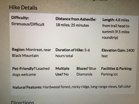
Right-hand side, second little bold factoid--Elevation Gain: 2400 feet.
Now, coming from California, this isn’t that big of a deal. It shouldn’t be. The Verdugo Mountain trail I used to take from Stough Nature Center in Burbank has a 1600 foot elevation gain over about 4.5 miles. It’s tough and I haven’t done it ages, but I could do it again working my way up to it.
Here on the East Coast, most elevation gains top out at 650-850 feet, and that’s considered insane. So I didn’t even think to look (or again, brain blind-spot.)
The drive there was a half hour and the little town of Montreat was cute and disturbingly concise. It had a conference center, church, and even an stone arched entranceway into the town.
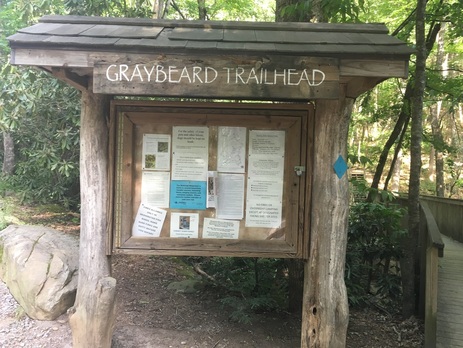
The board near the trailhead gives a few more warnings like make sure you have 6 hours to get there and back, take a lot of water with you, and that this is for experienced hikers. These are warnings I see for hikes with elevation gains of 800 feet, so I again ignore it completely and continue walking, passing by happy hikers on their way down.
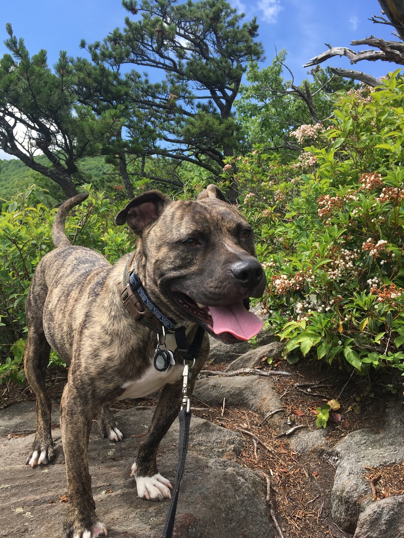
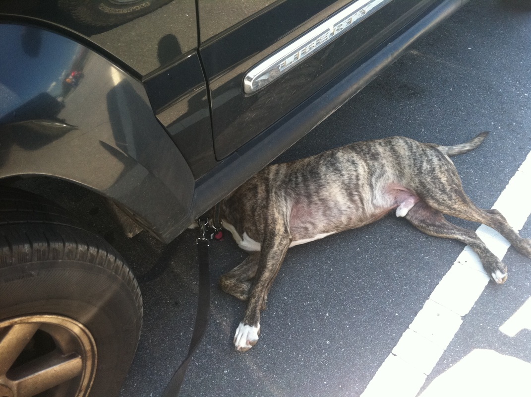
Tucker and I have the trail to ourselves after what must have been the “morning hikers” had done their journey and were having lunch in town. Their faces belied any sort of strenuous journey. Or perhaps it was because none of them were an overweight, out-of-shape, 38 year old woman. For that demographic, I can tell you it was tough. The steep incline wasn’t just that last mile and a half. It was a steep incline from the very beginning.
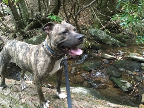
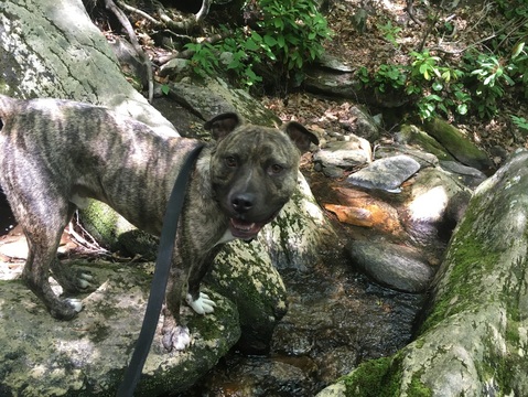
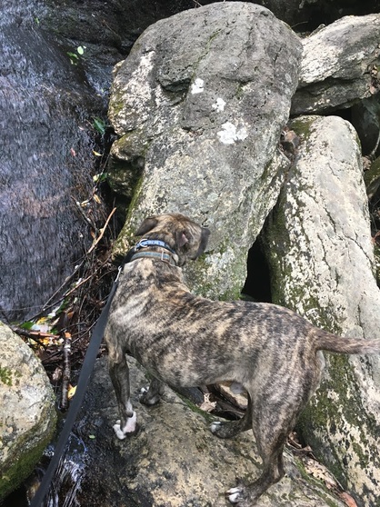
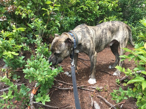
There were some pretty streams, which Tucker enjoyed.
Tucker and I have the trail to ourselves after what must have been the “morning hikers” had done their journey and were having lunch in town. Their faces belied any sort of strenuous journey. Or perhaps it was because none of them were an overweight, out-of-shape, 38 year old woman. For that demographic, I can tell you it was tough. The steep incline wasn’t just that last mile and a half. It was a steep incline from the very beginning.
There were some pretty streams, which Tucker enjoyed.
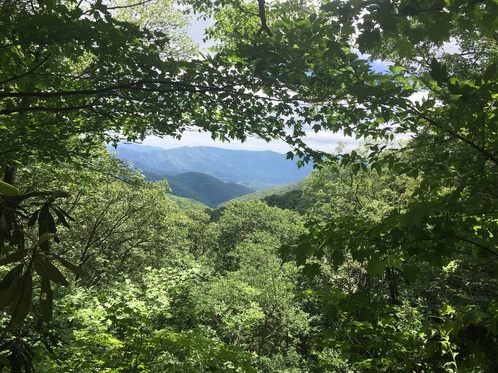
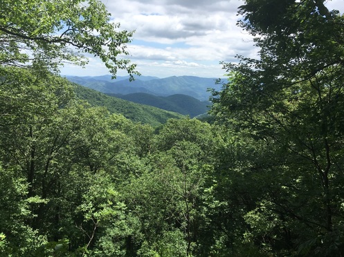
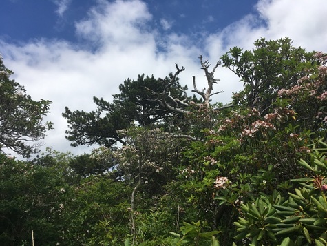
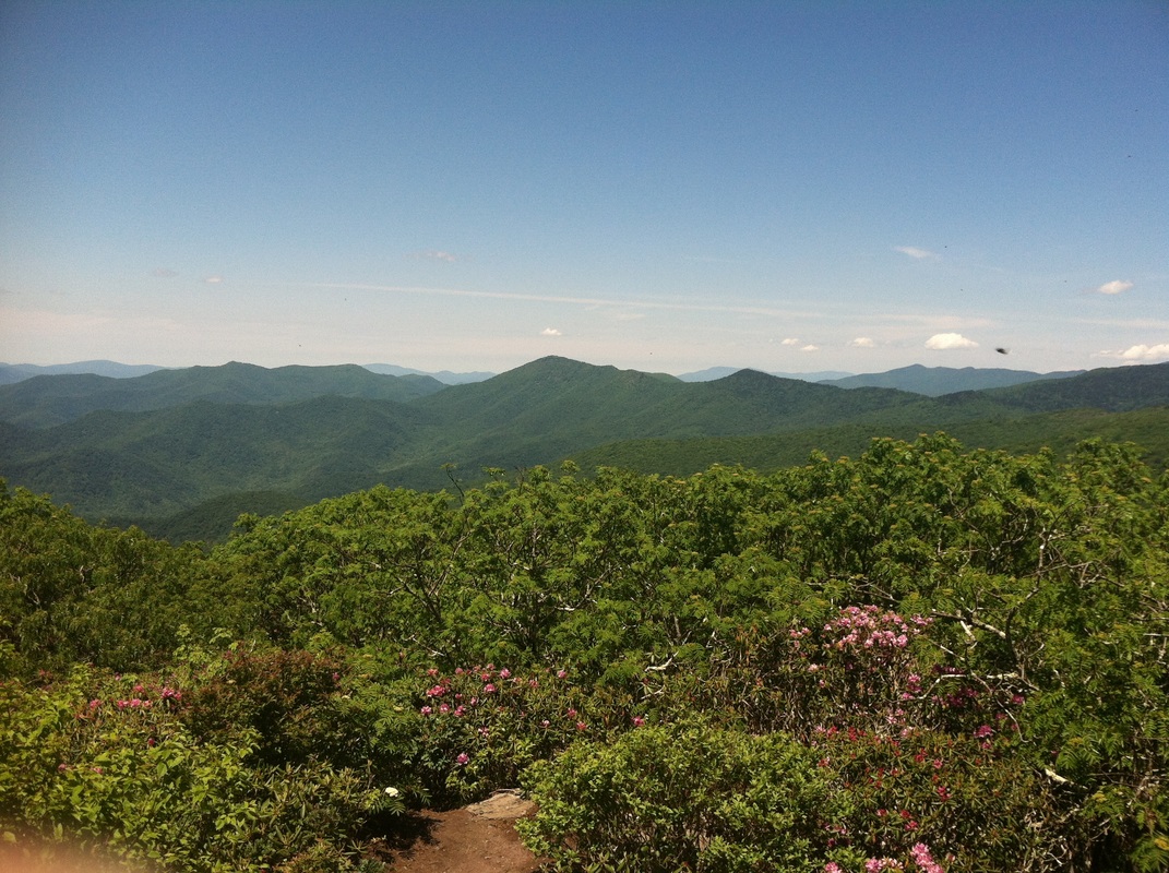
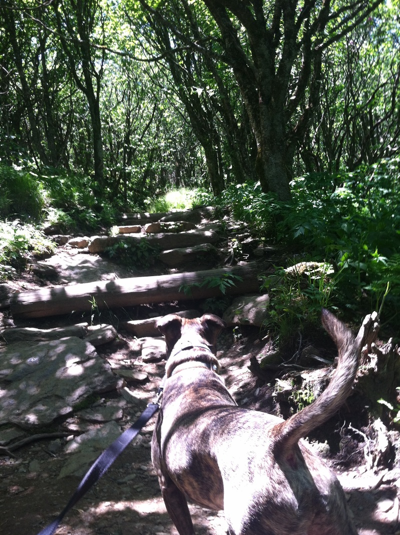
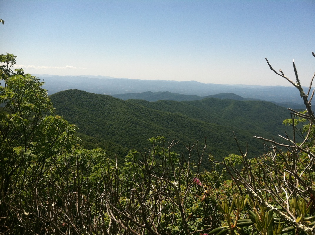
And indeed, there were some views along the way. I imagine in winter and fall when the trees aren't quite so robust, there are even more broad vistas. But I like the way the close trees frame my view.
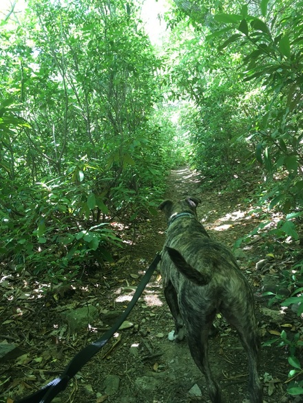
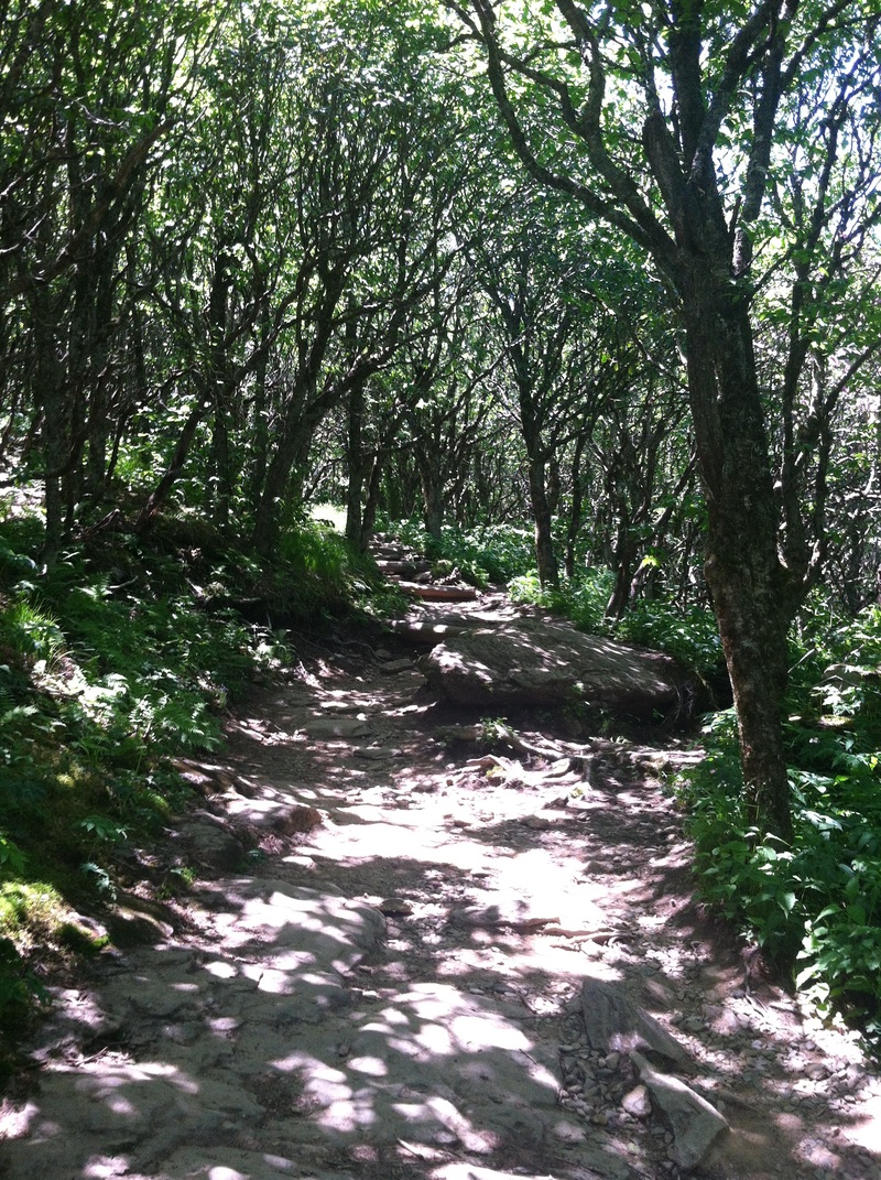
In some places the foliage is so thick, the trails take on an eerie green light in some tunnels.
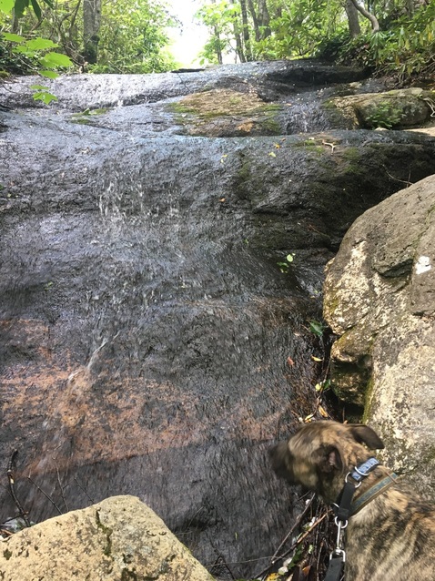
Two hours in, I figured we must have missed Greybeard Falls as we were on a flat area of trails, a welcome diversion from the constant uphill battle. But then as we came to yet another switchback, I saw the little wooden board with “Greybeard Falls —>” painted on it.
What?!?!?!
I'm pretty sure I said that outloud. We had been walking for over two hours. I walk 3 miles an hour on flat surfaces. 1.5-2 miles per hour when hiking. We should have been to Walker Knob by now, if not the Summit.
I took the spur trail which was only a few feet (in my estimation) to see the unimpressive falls and reassess if I had enough water and stamina to keep the journey going.
Even Tucker seemed slightly disappointed with the waterflow. "This is it?"
But the thing is: I don’t have a choice. Tucker loves hiking, and as much as he takes the journey as the destination, there always is a destination and dammit we’re not leaving until we get there. This is why loop trails are better for us: he doesn’t hold his ground, refuse to move, and give me that deflated look when I tell him it’s time to turn around. At any peak, he’ll keep searching for a trail for us to continue onward. The boy just doesn’t stop.
So, onward and upward we went--on the real trail, not the more challenging route Tucker tried to take.
When I was about to give up, knowing full well Tucker would not forgive me if we did, two hikers headed our way.
“Hi! How much further?” I ask between beads of sweat and gasping for breath to the young man and woman who looked to be about ten years younger and in way better physical condition than me.
“Well, we only went to Walker Knob. We were going to the Summit, but by the time we reached Walker Knob we decided that was it.”
“I came to that conclusion about twenty minutes ago too. How much longer till Walker Knob?”
“Oh, I don’t know,” the young man said. “Not far though. Keep going. You’re almost there.”
He smiled encouragement as did his silent female partner, and Tucker and I continued our ascent.
Indeed it wasn’t much further when we reached the Walker Knob Shelter. Someone kindly made a sign indicating that one trail led to the latrine, so I could only assume the other trail was to the lookout.
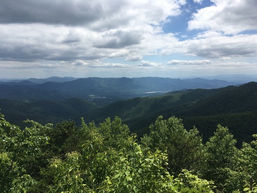
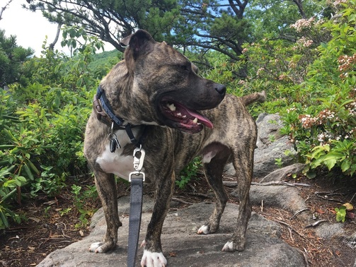
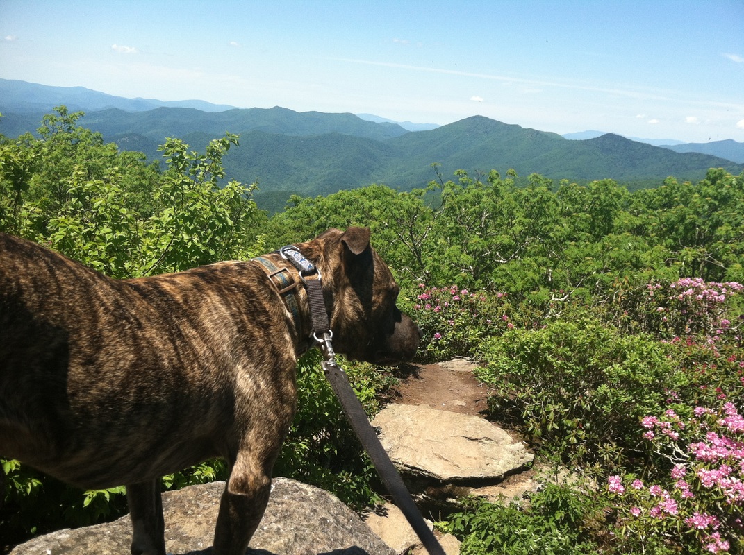
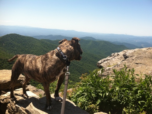
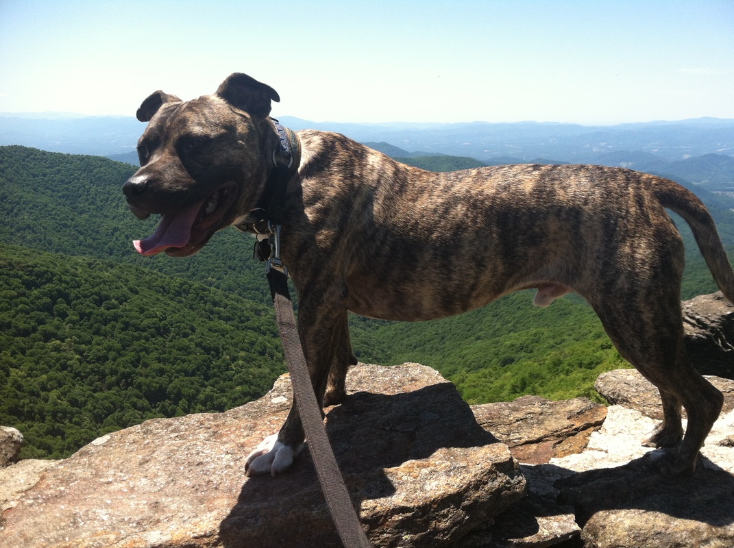
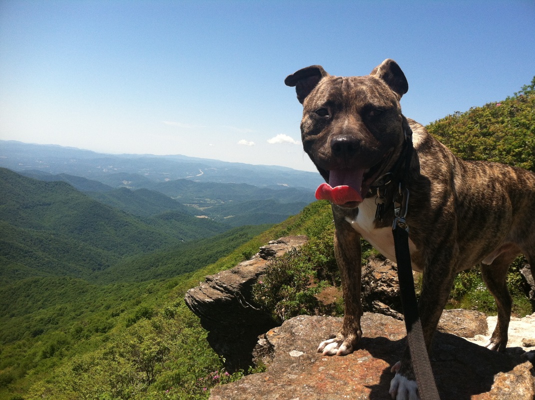
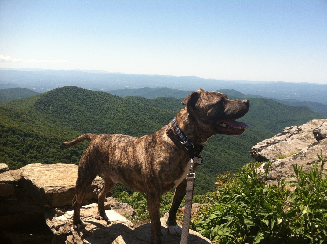
After spending over three hours just to go three miles, the little rock outcropping was a welcome reward. Tucker concurred.
When I was about to give up, knowing full well Tucker would not forgive me if we did, two hikers headed our way.
“Hi! How much further?” I ask between beads of sweat and gasping for breath to the young man and woman who looked to be about ten years younger and in way better physical condition than me.
“Well, we only went to Walker Knob. We were going to the Summit, but by the time we reached Walker Knob we decided that was it.”
“I came to that conclusion about twenty minutes ago too. How much longer till Walker Knob?”
“Oh, I don’t know,” the young man said. “Not far though. Keep going. You’re almost there.”
He smiled encouragement as did his silent female partner, and Tucker and I continued our ascent.
Indeed it wasn’t much further when we reached the Walker Knob Shelter. Someone kindly made a sign indicating that one trail led to the latrine, so I could only assume the other trail was to the lookout.
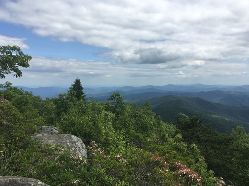
After spending over three hours just to go three miles, the little rock outcropping was a welcome reward. Tucker concurred.
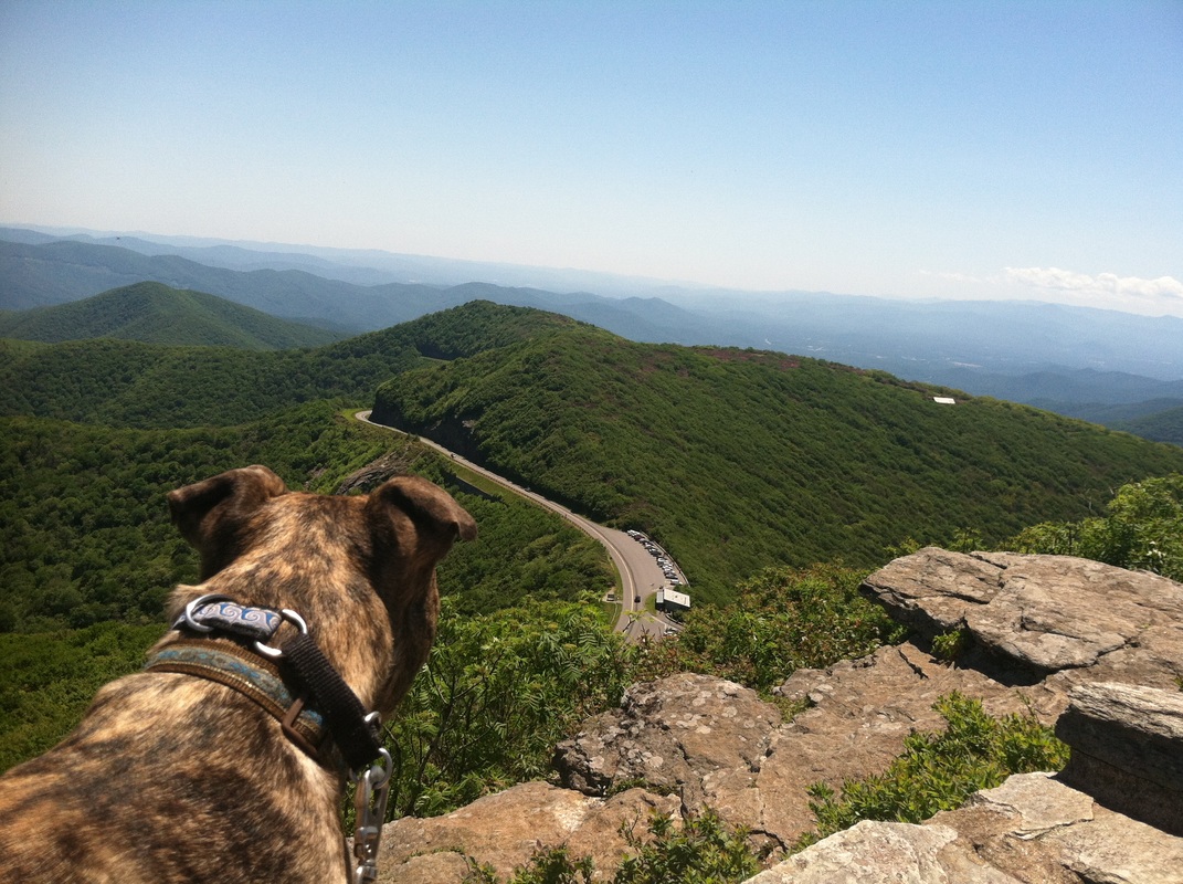
The view was great, although I think better views with less effort abound in these mountains. I realize I'm a landscape-snob for having just written that, but to me the entire world is beautiful. The effort to experience it is the only variable.
Of course, had my brain recognized the 2400 feet elevation gain, I wouldn’t have been as disappointed… or let's be honest, I probably wouldn’t had even tried.
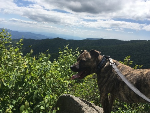
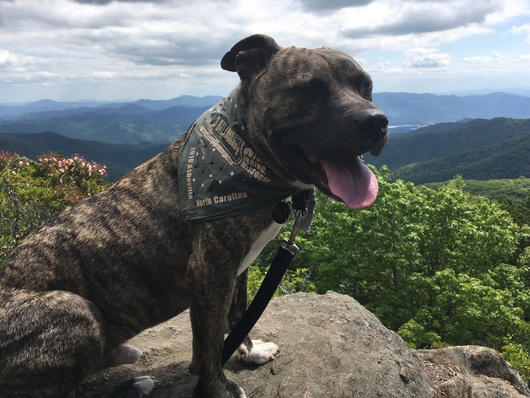
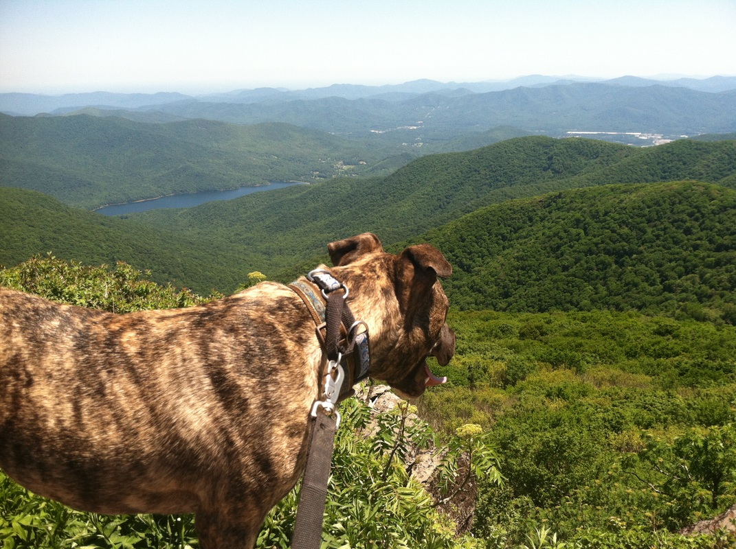
As a wrap gift, we received bandanas with the name of the film on them: Three Billboards Outside Ebbing, Missouri. Tucker wore his to the unofficial wrap party, but I wanted him to wear it again to get a shot of him overlooking Asheville. The hike had not been kind to me, and had been even less kind to the bandana that got wet, wrinkled, and crushed at the bottom of the my backpack during the previous three hours. So let’s just not see that it’s wrinkled, much like I didn’t see 2400 foot elevation gain, shall we?
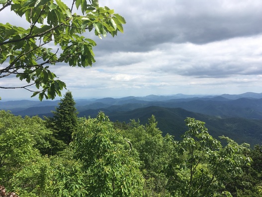
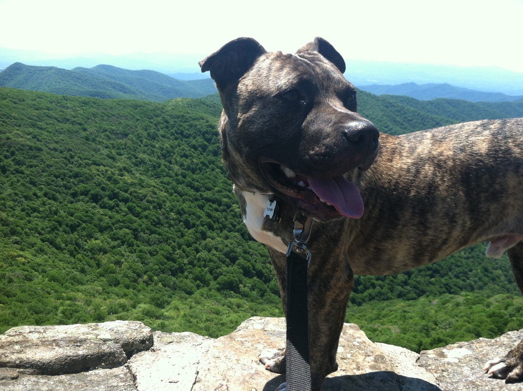
Tucker and I stayed for a short spell, but I knew I’d run out of water if we didn’t leave soon. Tucker explored the little area...
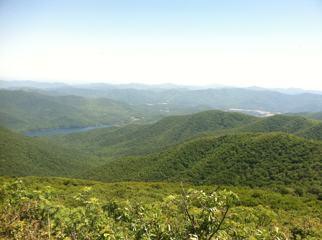
...and I remembered to turn around and take in the view from the view.
So often people look outward when they get to a view and forget that turning around to see where they’ve come from is just as beautiful in its own way.
Ten minutes down the mountain, a lone female hiker was huffing and puffing her way up. “Am I almost there?” she asked. She was in way better shape than I, and she wasn’t having a fun time.
“Yes, I just left Walker Knob. You’re almost there.”
“Is it worth it?” she asked. “I was about to turn around when I saw you guys.”
“Definitely don’t turn around. It’s worth going to Walker Knob. I didn’t make it to the Summit.”
“Okay, thanks.”
She continued, and I restrained myself from saying, Yes, it’s worth it to go on from here, but if I met you half a mile in, I’d tell you to turn around.
That’s not to say the hike wasn’t worth it at all. Tucker and I got in some exercise. We spent the afternoon in the woods. We did reach at least one peak, and the view truly was grand--as it has been from every summit we've climbed.
And it reminds me of the hikes we’re going to have back in California in only a couple weeks’ time. It reminds me how much I need to get into shape.
That being said, the next day we opted for something more along my current fitness level--Warren Wilson College Creek, where the view from the parking lot (actually a patch of gravel on the side of the road) was this:
That being said, the next day we opted for something more along my current fitness level--Warren Wilson College Creek, where the view from the parking lot (actually a patch of gravel on the side of the road) was this:
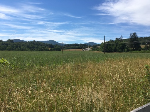
Okay, admittedly, this is not as grandiose as the view above, but you wouldn't have the mountain peaks that created that vista if you didn't have valleys like this below.
Whether your traverse the valleys or climb the mountains, a walk in the woods or in the meadows is as good for your body as it is for your soul. Some journeys are more difficult than others, but either way you end up right where you wanted to be: surrounded by, and a part of, the beauty of nature.
Whether your traverse the valleys or climb the mountains, a walk in the woods or in the meadows is as good for your body as it is for your soul. Some journeys are more difficult than others, but either way you end up right where you wanted to be: surrounded by, and a part of, the beauty of nature.
 RSS Feed